



After several days of heat, humidity and rounds of thunderstorms, we are finally starting to see some changes across Central and Eastern Kentucky.
We started Monday with another round of showers and storms moving through the area after an active Sunday evening. Most of that morning activity has since moved out, leaving us with a quieter afternoon. A few additional showers and storms will still be possible through this evening, especially across Southeastern Kentucky, before drier and more comfortable air settles in tonight.
A few more storms possible Monday
While most of us are drying out this afternoon, we are not completely finished with the rain just yet.
A cold front continues to slowly push southeast across Kentucky, and that could help spark a few additional showers or isolated thunderstorms this afternoon and evening. The best chance will be across Southern and Eastern Kentucky, particularly near and east of I-75.
The overall threat for severe weather is very low, but any storm that develops could still bring brief heavy rainfall, gusty winds and lightning.
Temperatures will depend on exactly where you are compared to the front. Most of us should reach the mid to upper 80s, while locations farther south could still climb into the upper 80s or around 90 degrees.
Cooler and more comfortable tonight
By Monday night, the cold front will finally push southeast of the region, allowing high pressure to begin building in.
That means we will not only dry things out, but we'll also start to feel a noticeable drop in the humidity. Overnight lows will fall into the mid to upper 60s, making for a much more comfortable night compared to the warm and muggy nights we've experienced recently.
Sunshine returns Tuesday
Tuesday is shaping up to be one of the better weather days we've had in a while.
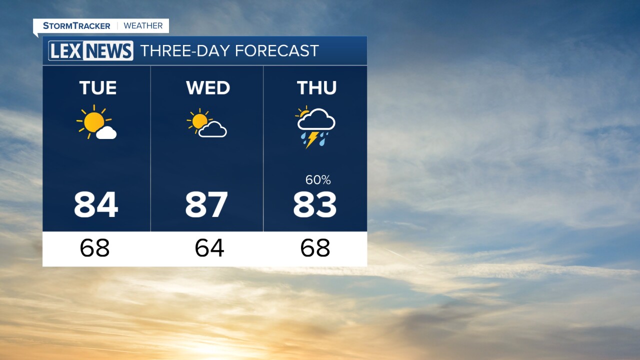
High pressure will keep us dry with plenty of sunshine throughout the day. Afternoon highs should reach the low to mid 80s for much of Central and Eastern Kentucky, with some upper 80s possible farther south.
The lower humidity will also make a big difference, so even though temperatures will remain warm, it should feel much more comfortable outside.
Tuesday night will be even cooler, with overnight lows falling into the low to mid 60s.
Storm chances return late Wednesday
Most of Wednesday should remain dry as temperatures warm back into the mid to upper 80s, with a few locations farther south potentially reaching the low 90s.
Our next weather system will begin approaching the Ohio Valley late Wednesday, bringing increasing chances for showers and thunderstorms Wednesday night.
Those rain chances will continue into Thursday and possibly early Friday as another cold front moves through. It's still too early to determine whether any of those storms could become strong or severe, but we'll continue watching that potential over the next couple of days.
Temperatures stay in the 80s
Clouds, showers and the passing cold front should help keep afternoon temperatures in the 80s Thursday and Friday. Rain chances should gradually decrease heading into the weekend, although a few isolated showers or storms could remain possible.
Overall, we're finally getting a break from the persistent heat and humidity, with several days of much more seasonable temperatures ahead.
