


The recipe for locally heavy rain is in place for us tonight and tomorrow. The air is tropical and moisture laden. There is a parameter called precipitable water which measures the amount of water in a column of the atmosphere, and it's around 2", which is very high for us. That means as these storms get going they can tap into a vast water resource. The trigger to get the storms going is a front which is just inching its way southward which can cause repeated rounds of heavy rain for many of us. The slow motion is caused because there simply is no push in the atmosphere. The flow is basically parallel to the front.

When we look at the rainfall map it shows very specific numbers for different locations. Those numbers will change model run to model run at that level of detail. However, what the model IS telling us is that there will be corridors of very heavy rain caused by the weak steering flow and the overall flow running along the front. Within those corridors, several inches of rain and flooding are possible. Away from those corridors, the rainfall amounts will be less, along with the flooding risk. What the model is also showing is there may be some bullseyes where some folks may end up with 3 and 4+ inch rain totals, in addition to the folks who may end up with only fractions of an inch, and no problems.
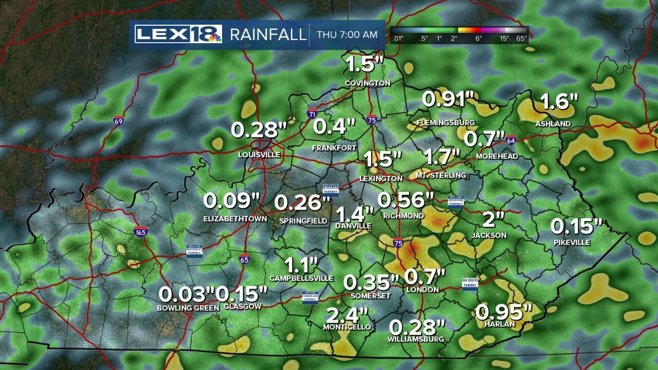
Regardless, due to the lack of uncertainty of where those corridors will end up, a Flood Watch is up area wide through Wednesday evening. Stay Weather Aware as these heavy thunderstorms get going.

By the weekend, Canadian air arrives as we will see the humidity cut, the rain go away and we'll enjoy a September preview.
