

After record warmth Thursday afternoon, a strong cold front is on the way Thursday night and into Friday. Most of the night will continue with the pre-summer warmth, but temperatures will fall behind the cold front as it begins to move through the area late tonight.
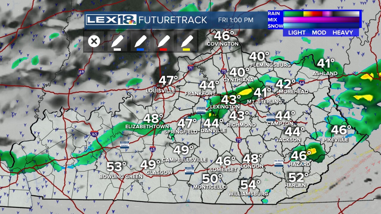
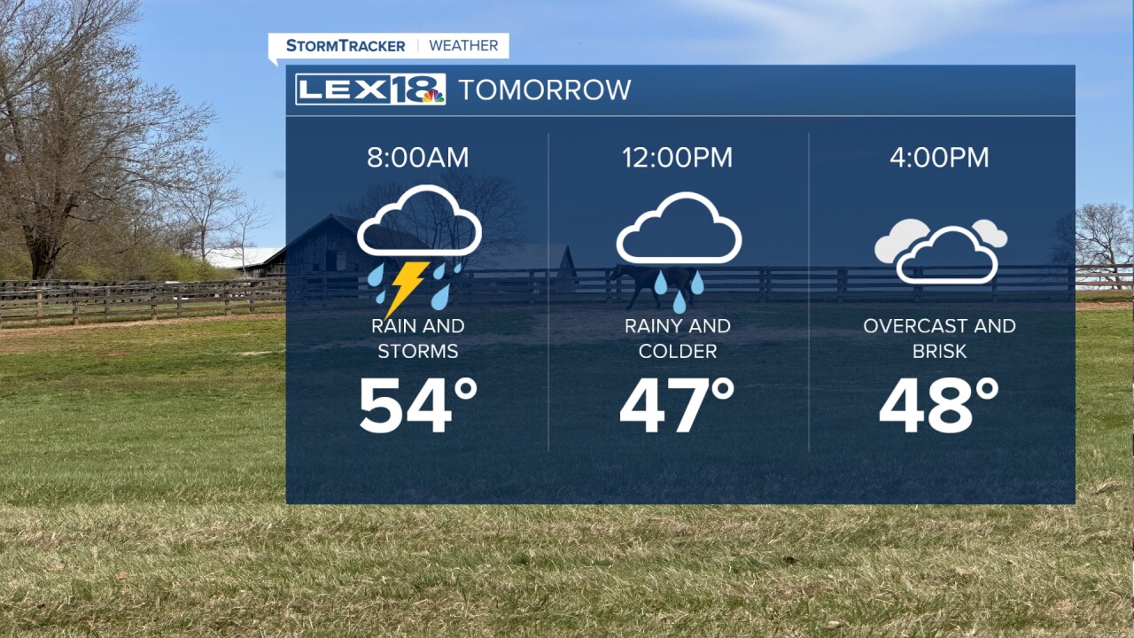
Rain and thunderstorms will be moving through by late Thursday night and into the day on Friday. At this point, the storms don't look to be severe, even with the big temperature drop that's coming.
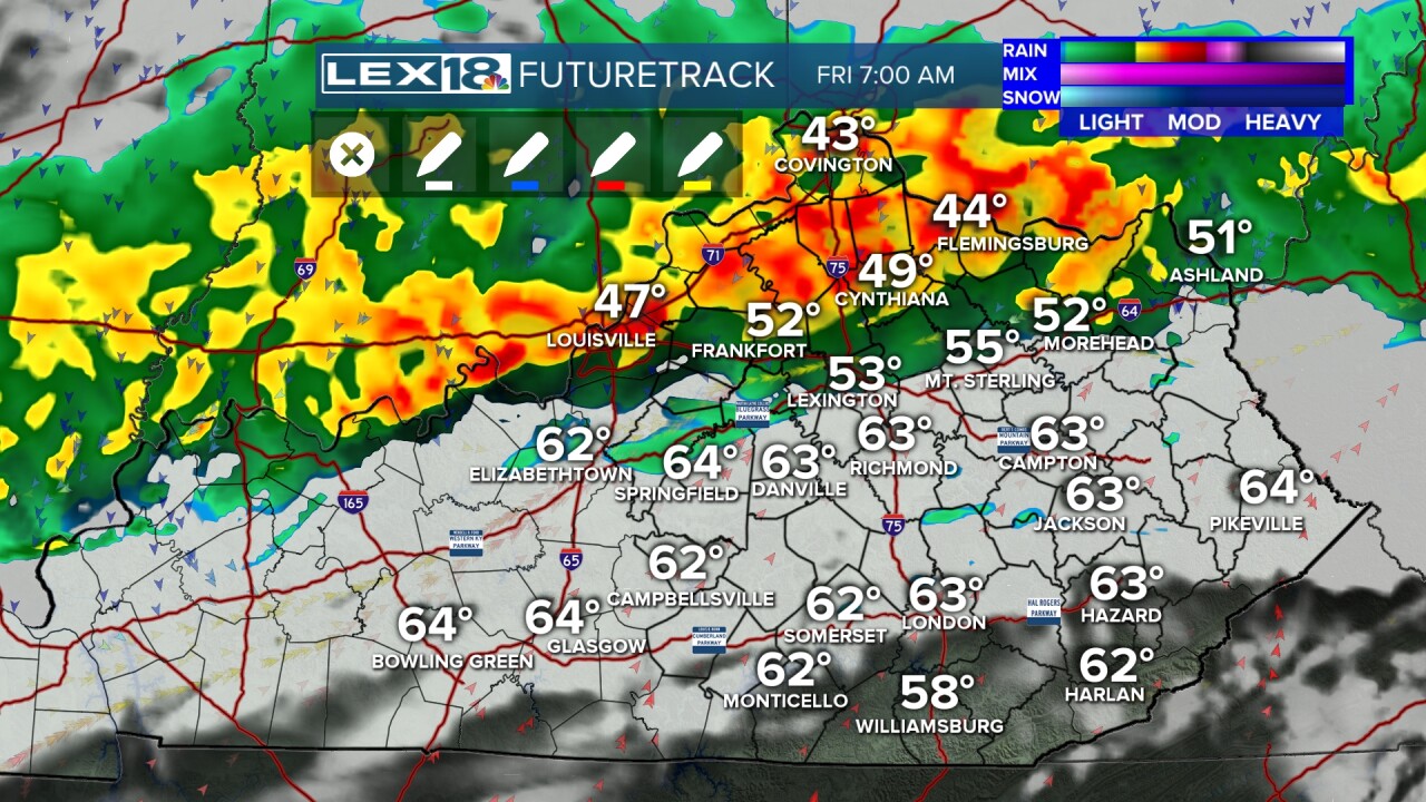
On Friday, the morning temperatures will end up being the highs for the day. As the cold front and rains come through, our temperatures will fall back into the 40s for most of the day making for a brisk and blustery afternoon.
We also have a freeze watch in effect for Saturday morning as lows will drop back to the upper 20s and low 30s to start the final weekend of March.
