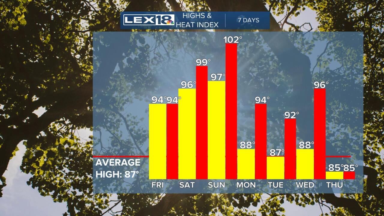
The heat wave that has plagued the Plains states for the last few weeks is nudging our way this weekend. As if it was cool today (with a high in the low 90s), it's going to be getting even hotter starting tomorrow and even more so this weekend. What is happening is the giant ridge of high pressure in the upper atmosphere, that meteorologically is called a Sonoran Heat Ridge, is sending a piece our way. It's arrival will send temperatures into the middle 90s tomorrow, middle and upper 90s Saturday, and upper 90s on Sunday.

Today was the 24th 90 degree day we've had so far this year. We're way above where we should be on July 21st which would be 10 such days. The last time we had this many was in 2012, so it's been 10 years since we started a summer like this. What's really interesting is when you look at it historically, hot summers were much more common in the period from the 1930s through the 1950s with 8 of the top 10 number of 90 degree days from that era.

Not only will the heat be around through the weekend, but plenty of humidity will be with us also taking our heat index values into the 100+ realm. There is some good news though. After the heat peaks this weekend, next week is looking significantly cooler with highs back down into the 80s. There are also rain chances each day next week.

We've seen enough rain in the last 2 weeks that there has been a significant improvement in the US Drought Index for us. Over the last week we've seen a 25% improvement in the folks who were under some degree of drought compared to last week. Since the 4th of July week, we've seen the areas of Kentucky plagued by drought nearly cut in half. At this point, less than half the state still has what is meteorologically considered drought.

The bottomline for us, deal as best as you can with the heat this weekend because there is some relief coming next week.


