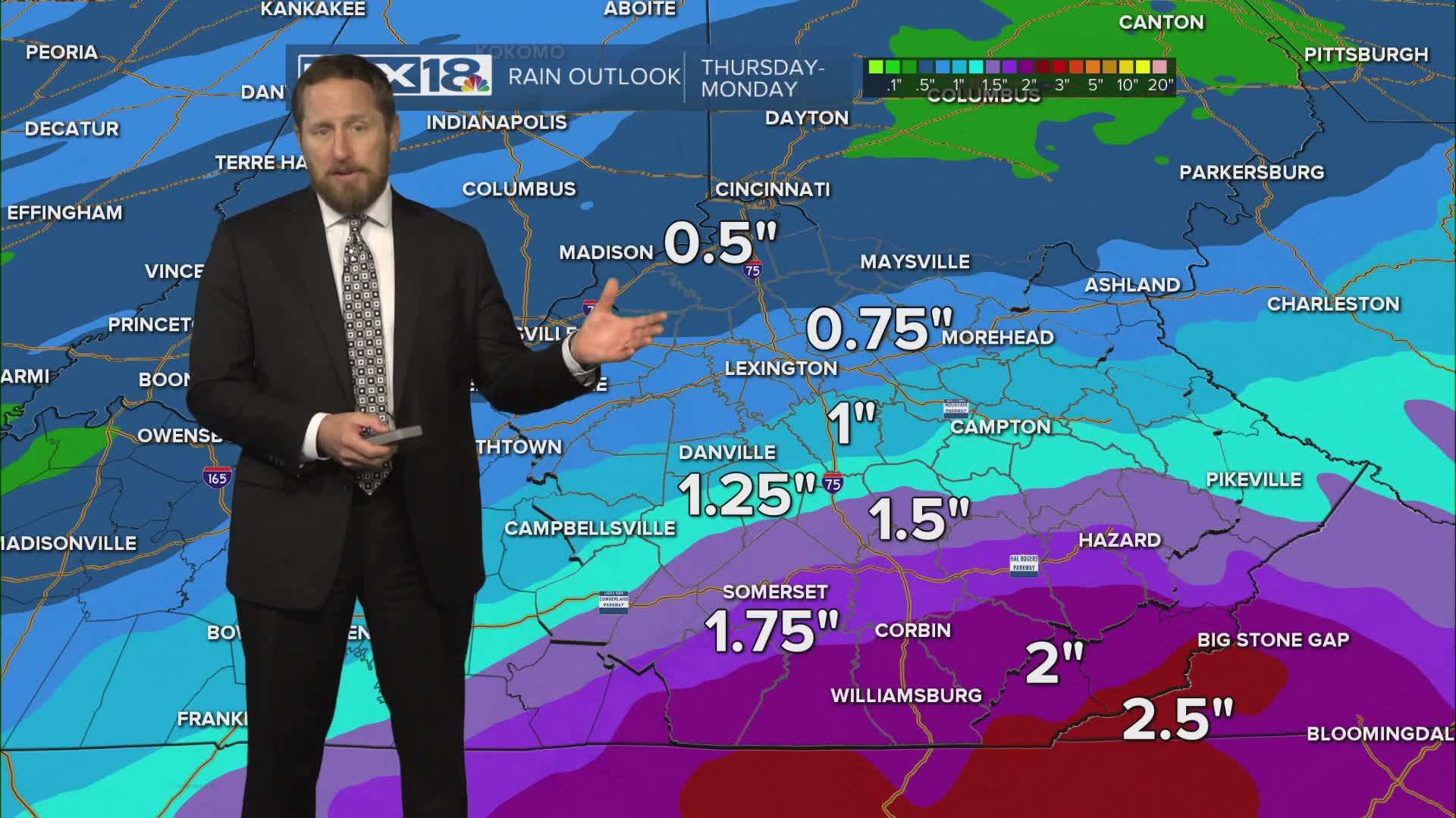


It's not feeling much like winter out there as we wrap up the work week! A gusty southerly wind will drive highs well into the 60s Thursday with near record highs possible Friday. Along with the unseasonable warmth, expect increasing cloud cover with a few showers Thursday and widespread showers and storms likely Friday. While the main severe storm threat stays to our south, we'll need to watch for gusty storms and locally heavy rain. Showers continue overnight into Saturday morning with highs in the 50s Saturday afternoon. A second cold front will usher in significantly colder air Saturday night with sprinkles/flurries possible and Sunday's high crashing to the mid to upper 30s.
