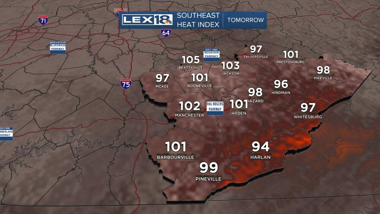
Wednesday is our 'break' from the rain, but it comes at a price. Temperatures will head into the low 90s but with the very high humidity the Heat Index will be over 100 in the afternoon. It's the humidity even more than the temperature which makes it harder for us to deal with the heat. Dew points tomorrow are likely heading into the mid and even some upper 70s.
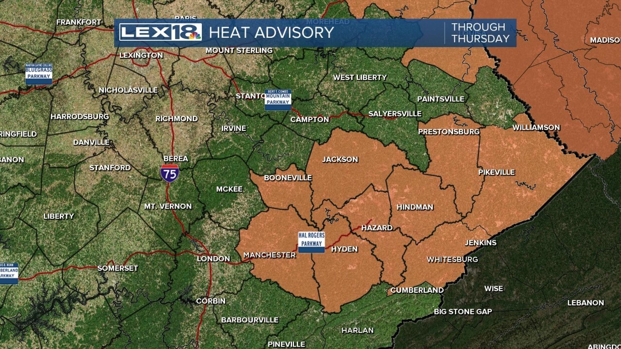
This has forced a somewhat unique Heat Advisory for tomorrow and Thursday. The Heat Advisory is in the flood zone of Clay, Owsley, Breathitt, Leslie, Perry, Knott, Floyd, Letcher and Pike counties. Normally, a Heat Advisory is issued when the Heat Index gets to 105. We won't be reaching that level tomorrow.

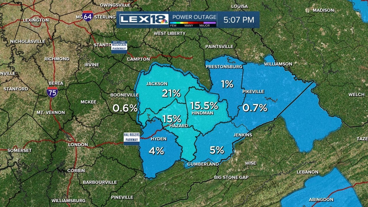
The lack of electricity in the flood zone has prompted this Advisory. With parts of these areas having 15 to 20 percent of folks without electricity or air conditioning, the advisory is a reminder to take care while going through the mountainous job of cleaning up.

The forecast Heat Index values in southeastern Kentucky tomorrow will be peaking in the low 100s during the afternoon. Again, it wouldn't normally have prompted a Heat Advisory, but these are very special circumstances.

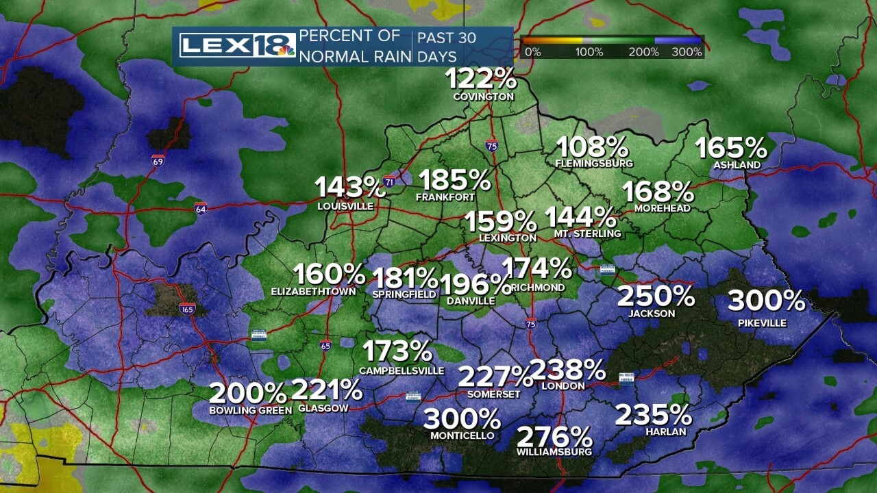
Another note with the rainfall. We have an algorithm that tracks the rainfall compared to normal. Over the last 30 days south of I-64, we're more than double the normal amount of rain. There are parts of southeastern Kentucky in the flood zone that are over 300%, TRIPLE, the amount of rain for the last month. Our scale only goes to 300% figuring that it really could never get beyond that, but it did. All that dark area of southeastern Kentucky and even south of Monticello are areas with more than triple the amount of normal rain in the last month...somewhere between 15 and 20 inches.

We will see rain chances increase again late this week and into the weekend.


