

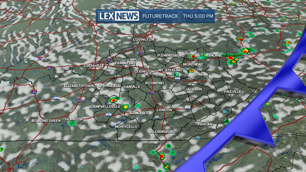


After a fantastic stretch of unseasonably pleasant weather to begin the week, the warmth and humidity has returned to Central and Eastern Kentucky. A southwest wind will continue to push warm and muggy air into the commonwealth as a slow moving front slides in from the west on Thursday. The storms should be hit and miss and not everyone will see rain, however any storm that pops could produce some localized heavy rain.
Hopefully the clouds break apart enough this evening for the "partial" lunar eclipse that we'll see here in the eastern U.S. with the "peak" happening just after Midnight into Friday morning. Even though it's designated as partial, 96% of the moon will be covered by the earth's shadow at its peak so it should be mostly covered and have a red and orange hue to it, thus the reference of a "Blood Moon" Again fingers crossed that we'll see enough breaks in the clouds in order to see it.
As the front moves along, we should be back to mostly sunny skies with a northeast wind bringing in slightly less humid air on Friday. Other than a stray shower in the mountains of Southeastern Kentucky, it looks like a dry Friday with afternoon highs topping out in the mid-80s. Fortunately it should be another good night for week 2 of high school football across the commonwealth.
Closing out the final weekend of August, dry weather will be in place with more warmth and humidity expected to build into the Ohio Valley. Afternoon highs should top out in the upper 80s both days so slow it down if you have any outdoor activities planned over the weekend. The upward trend in temperatures will continue to finish out August and kick of September early to mid next week as highs reach the low and even a few mid-90s! There will be some humidity around, but it shouldn't be high enough to push heat indices into the danger zone, although you'll need to use a little common sense during the hottest part of the day.
