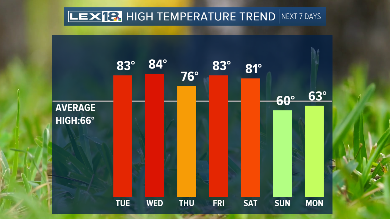


Happy Monday! It was another warm day across the Commonwealth as we saw scattered showers and storms roll through. Tonight, temperatures will remain warm, with overnight lows in the upper 60s under a mostly clear sky. Tuesday will be much warmer, with temperatures rising back into the mid-80s. A couple of showers will be possible in the south, but most of us will be dry. Wednesday will be our hottest day, with highs close to our record high (84). As our upper-level high begins to break down, rain chances will increase on Thursday along a cold front. Scattered showers and storms are possible during the day. Another cold front will arrive by Saturday, bringing more showers and much cooler temperatures.
Hotter days ahead for the workweek
Highs to reach the mid-80s for much of the workweek.
