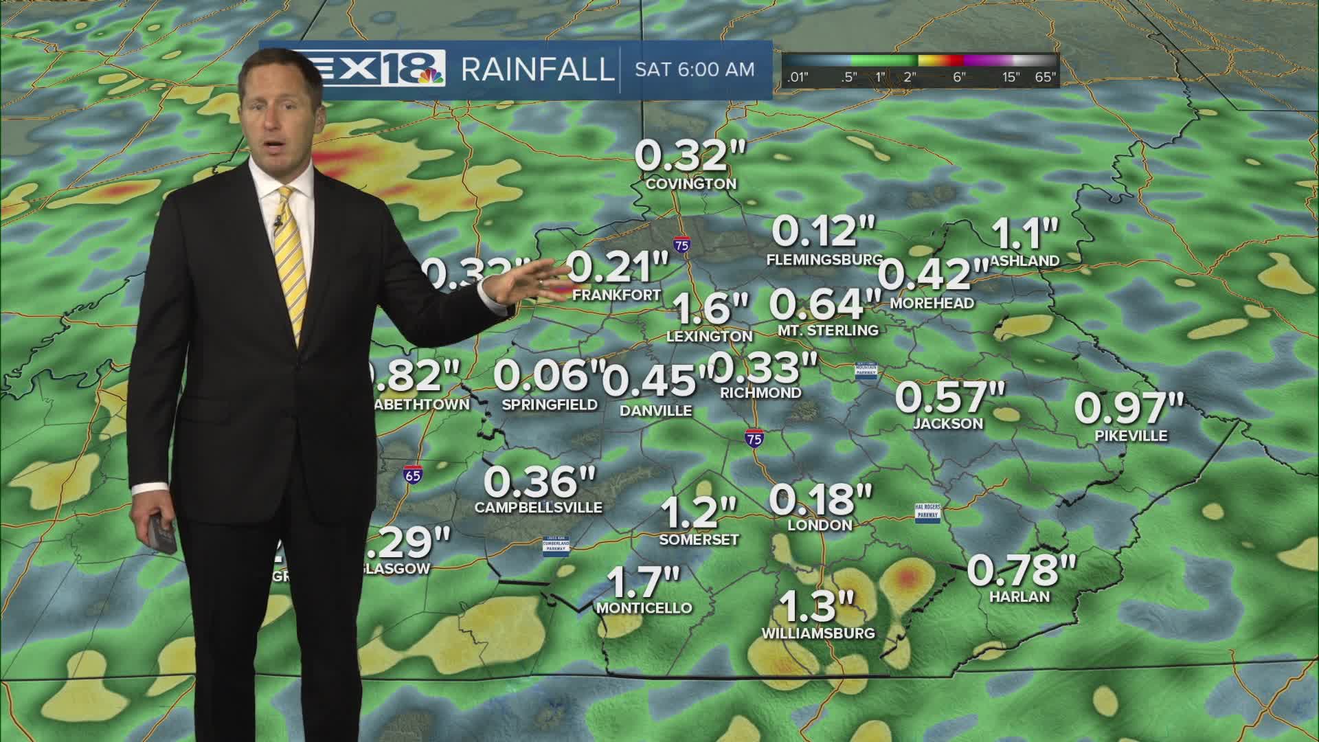


A cold will front drop south and stall near the Ohio River Thursday, sparking an afternoon/evening round of showers and storms that will slowly cross the area heading north to south. We're under a marginal risk for severe storms, watch for strong wind gusts and torrential rain that could lead to localized flash flooding. A flood watch is in effect through Thursday evening. Expect another hot and humid day with highs in the upper 80s to low 90s and the heat index pushing triple digits, just below heat advisory criteria. The front lifts north Friday and we'll stay stuck in that very warm, muggy and unsettled state we've been in all week heading into the weekend. We'll see highs in the mid to upper 80s with more showers, storms and heavy rain on and off through early next week.
More Scattered Strong Storms and Heavy Rain Thursday
Flood Watch in Effect Through Thursday Evening
