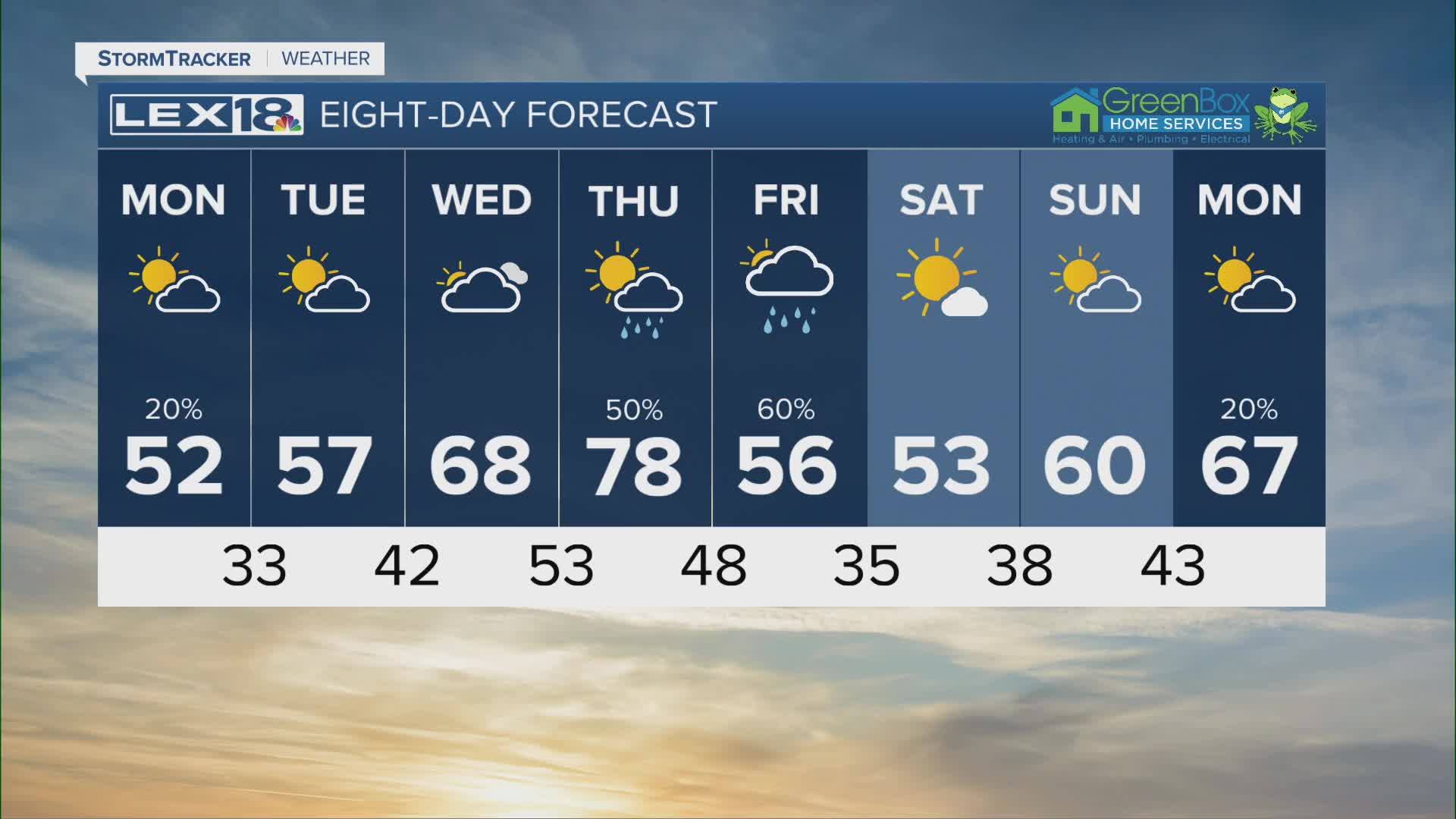


After record breaking highs in the 80s Sunday and an overnight round of showers and storms, we're much cooler and dry Monday. Expect morning clouds to give way to afternoon sunshine with highs in the low to mid 50s, about 30° cooler than yesterday. The north wind pulling in colder air will be gusty at times, accentuating the chill. We'll see lows around freezing with patchy frost possible Tuesday morning. High pressure takes over through midweek with partly sunny skies and highs gradually warming from the upper 50s Tuesday, into the 60s Wednesday and topping out in the upper 70s to low 80s Thursday. A cold front will spark showers and storms (strong to severe storms possible) to start the weekend and cool it back down.
Much Cooler Monday
Sunshine Returns with a Warming Trend through Midweek
