

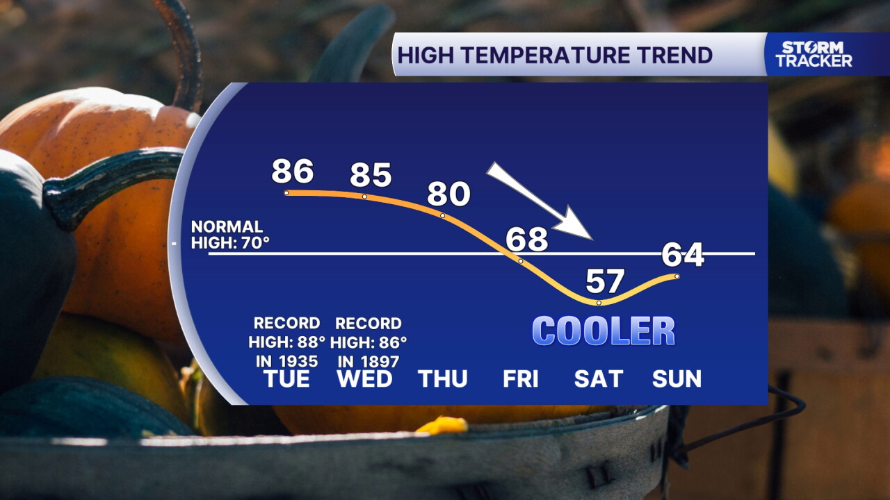
Unseasonable warmth spikes Tuesday and Wednesday with near record highs in the mid 80s. We'll see one last dry day Tuesday with increasing clouds and late day showers and storms developing Wednesday. A cold front briefly stalls along the Ohio River Thursday keeping rounds of showers going with highs around 80°. Much cooler air (the coolest of the season) follows the front this weekend. After lingering showers clear out Friday, sunshine returns but highs will fall to the 60s Friday and bottom out in the upper 50s Saturday. Watch for patchy frost as lows dip to the upper 30s Saturday and Sunday morning.
Near Record Highs Tuesday and Wednesday
Unsettled and Much Cooler Weather Later this Week
weather


Posted
 Facebook
  TikTok
  YouTube
 Instagram
 Threads
 X
XCopyright 2026 Scripps Media, Inc. All rights reserved. This material may not be published, broadcast, rewritten, or redistributed.
