

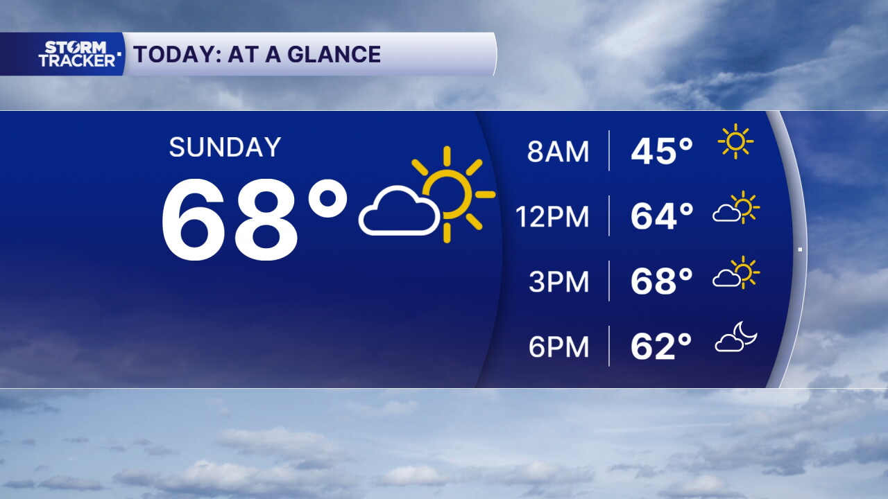


We are starting off our Sunday morning on a chilly note across Central and Eastern Kentucky, with temperatures in the 30s and 40s. However, another beautiful and unseasonably warm November afternoon is on the way!
Plenty of sunshine will stick around through the first part of the day before clouds gradually increase later this afternoon and evening. Temperatures will climb into the upper 60s and low 70s, giving us one more day of above-average warmth before some big changes arrive.
Our next cold front will bring showers late Sunday evening into early Monday, followed by much cooler temperatures just in time for Thanksgiving week.
One More Warm Sunday Before Changes Arrive
If you have any outdoor plans today, most of Sunday is looking great!
After a chilly start, temperatures will quickly warm into the upper 60s and low 70s across much of Central and Eastern Kentucky. That's around 10 to 15 degrees above average for this time of year.
We'll continue to see plenty of sunshine early in the day, with clouds gradually increasing as our next weather system approaches.
Most of the daylight hours will remain dry, but rain chances will begin increasing later this evening.
Showers Return Late Sunday Into Monday
A cold front will push across Kentucky late Sunday evening and overnight, bringing a band of scattered showers from west to east.
While some showers could produce a brief downpour, this system is not expected to bring significant rainfall totals.
Locations along and west of I-65 could receive around a tenth to a quarter of an inch of rain, while areas farther east, including the Bluegrass, will likely see a tenth of an inch or less.
Winds could also become gusty as the front moves through, with gusts around 20 to 30 mph possible.
Most of the rain should move out by Monday morning, but the colder air moving in behind the front will be hard to miss!
Much Colder Weather Arrives for Thanksgiving Week
After several days of temperatures in the upper 60s and low 70s, we'll see a noticeable cooldown beginning Monday.
Afternoon highs will only reach the upper 40s and low 50s across much of Central and Eastern Kentucky, putting us closer to or slightly below average for this time of year.
Monday could also be rather breezy, with northerly winds gusting around 20 to 25 mph, making it feel even colder outside.
Overnight temperatures will drop into the upper 20s and low 30s, and the cooler weather is expected to stick around through much of Thanksgiving week.
Rain Chances Return Around Thanksgiving
As we look ahead to Wednesday and Thanksgiving Day, another weather system could bring additional showers to Central and Eastern Kentucky.
Clouds will likely become more widespread during the middle of the week, with periods of light rain possible Wednesday and into Thanksgiving.
 Facebook
 TikTok
 YouTube
 Instagram
 Threads
 X
