


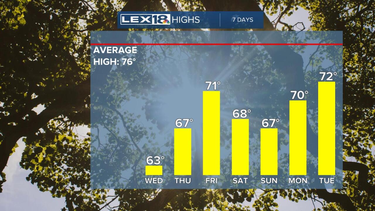
While Hurricane Ian is hitting Florida with full weather fury, our weather is going to remain remarkably calm, just a lot chillier than we'd normally see. We're going to be seeing temperatures tonight dropping into the upper 30s to around 40 and for some folks a tinge of frost is possible. The best chances will be in valleys as well as on your car windshield if you leave it out or up on insulated roof tops. It's not going to be a widespread killing frost.

We stay cool throughout tomorrow with highs only getting into the low 60s with a cloud/sun mix. That's a normal day for the latter part of October. As you look through the next week, there is nothing really warm that shows up anywhere, so the chill of autumn has certainly arrived.
Of course the big weather story is Hurricane Ian. It is a major hurricane and will likely be at least a category 4 upon landfall late tomorrow on Florida's west coast, likely south of Tampa. It's going to bring high winds, perhaps hurricane force all the way to the Orlando parks. It's also going to bring a high storm surge to the Gulf Coast of Florida from Tampa southward. In addition, heavy rain of 1 to 2 feet will be possible as well. It's going to take a couple of days for the storm to transit Florida.

Ian then may make a turn up our way by this weekend. If the remnants make that left turn and head our way, then we'll have to deal with some rain chances over the course of the weekend. Otherwise, we're looking dry.

