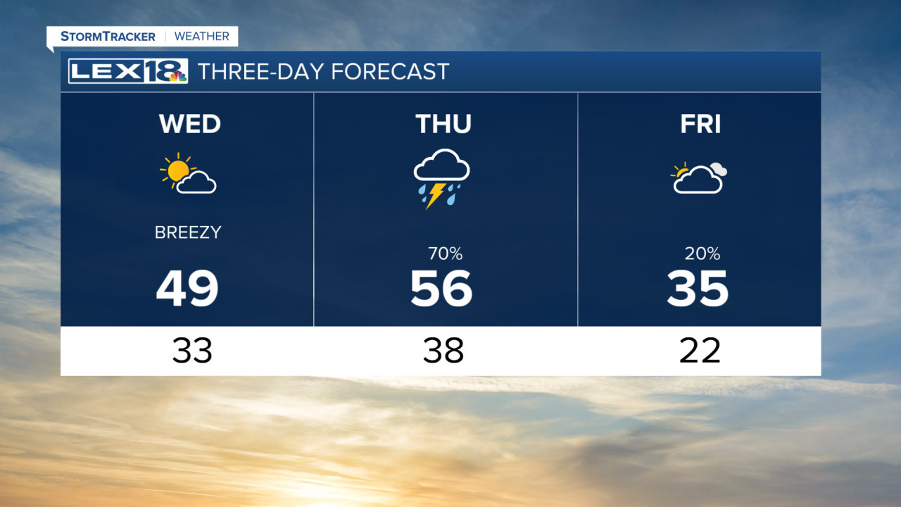


Our midweek warm-up continues, with highs in the 40s and 50s by Thursday. This evening will be warmer with overnight lows in the 30s under a mostly cloudy sky. Wednesday will be much breezier, with strong southerly winds warming us to the upper 40s by afternoon. Our gusty conditions will continue into Thursday as a strong cold front moves through the Commonwealth, bringing showers and storms. A few storms could bring strong wind gusts, but the severe threat is very low. On the back end of the front, temperatures will be much cooler on Friday, with a chance of snow showers early Friday morning. By the weekend, we will be back to above seasonal highs with temperatures in the upper 40s.
Our midweek warm-up continues
Highs to reach the 40s and 50s by Thursday
