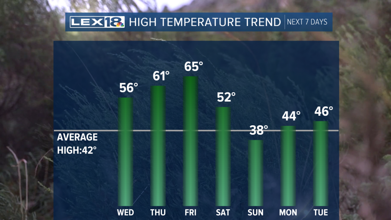


Hopefully, you have been enjoying our warm start to 2026, because we will stay warm through the start of the weekend. This evening will be slightly cooler than last night as we feel the effects of the weak cold front that passed on Tuesday afternoon. We will see temperatures in the lower 40s under a mostly cloudy sky. We will quickly return to the mid-50s during the day on Wednesday, with a mix of sunshine and clouds. Our rain chances will increase into Thursday as another cold front approaches, bringing showers and storms to the Commonwealth. By the end of the workweek, our highs will reach the mid-60s before falling to the 30s by Sunday.
Our warm start to 2026 continues for the rest of the workweek
Highs to reach the upper 50s on Wednesday afternoon.
