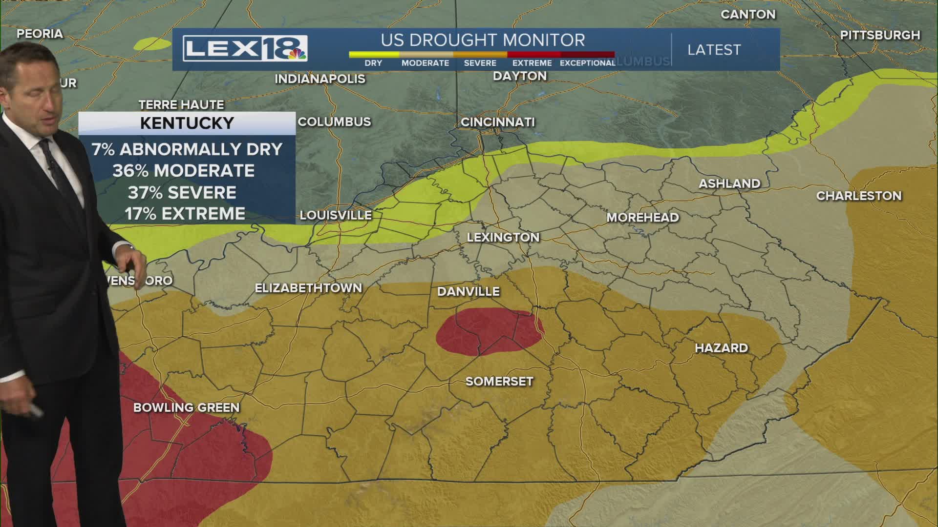


We'll see increasing clouds and highs in the low to mid 70s Tuesday, thanks to a strong southwest wind. We'll also see widespread rain on the rise late in the day and continuing overnight and through the day Wednesday. Scattered showers and storms will finally wind down Wednesday night as a cold front tracks east. Expect beneficial, drought damping rain in the 1" to 2" range. Much cooler air follows with Wednesday's high in the low to mid 60s and Thursday bottoming out in the upper 50s. All you gardeners out there, beware! Friday morning lows will drop to the upper 30s giving us yet another shot at patchy frost.
