

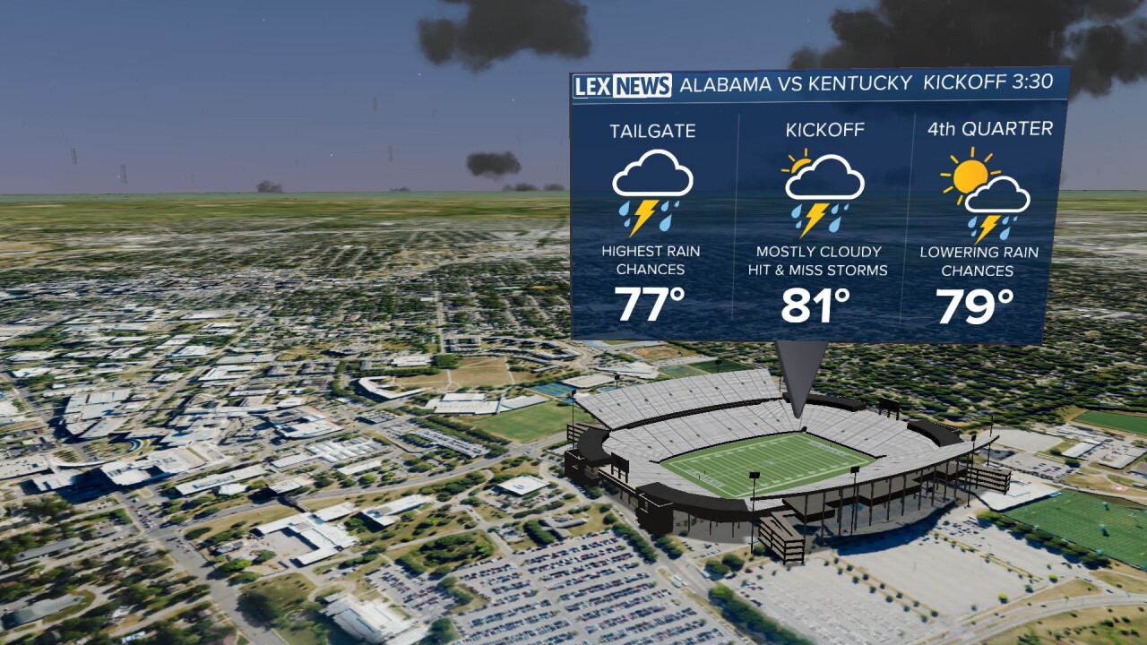


Saturday is starting off wet and muggy across Central and Eastern Kentucky, with showers moving through parts of the area, especially across Southern Kentucky. Temperatures and dew points are both sitting near the low 70s this morning, making it feel very humid as you step outside.
The unsettled weather will stick with us throughout the day as a stalled front remains nearby. Additional showers and thunderstorms are expected to develop, with locally heavy rainfall becoming our biggest concern this afternoon and evening.
More Showers and Storms Develop Today
We'll continue to see scattered showers throughout the morning before additional showers and thunderstorms become more likely during the afternoon and evening.
There is plenty of moisture available in the atmosphere, so any storms that develop will be capable of producing some pretty decent rainfall over a short period of time.
The showers and storms will remain scattered, meaning rainfall totals could vary quite a bit from one location to another. Some communities may see multiple rounds of rain, while others pick up considerably less.
Heavy Rain Could Lead to Localized Flooding
The biggest concern this afternoon and evening will be locally heavy rainfall, particularly across Northeastern Kentucky.
A Flood Watch is in effect for portions of Northeastern Kentucky through 1 a.m. Sunday. These areas have received more rainfall over the past few days, leaving the ground more vulnerable to additional heavy rain.
If multiple storms repeatedly move over the same locations, isolated to scattered flash flooding could develop. Even outside of the Flood Watch, localized flooding will still be possible beneath the heaviest showers and storms.
Rain Winds Down Tonight
Showers and thunderstorms should gradually become less widespread later tonight as we lose some of the daytime instability and the weather system responsible for our rain begins moving away.
A few lingering showers will remain possible, along with areas of fog developing overnight. By Sunday morning, however, most of us should finally begin drying things out.
Drier and Warmer Sunday
Sunday will bring a big improvement compared to Saturday.
Most of the area should remain dry with sunshine returning throughout the day, although a stray shower can't be completely ruled out. Afternoon temperatures will warm back into the mid and upper 80s, making for a much better second half of the weekend.
Summer Heat Returns Next Week
After a brief front moves through Monday, a strong area of high pressure will begin building across the region and bring another stretch of dry weather.
Temperatures will quickly climb well above normal by the middle of the week. Highs are expected to reach the upper 80s before climbing into the low 90s by Tuesday and Wednesday.
Wednesday currently looks like the hottest day, with temperatures potentially approaching record territory in some locations. Humidity will also increase again as dew points climb into the upper 60s and low 70s.
Rain chances should remain limited through the middle of the week before another cold front potentially brings our next opportunity for showers toward the end of the week.
