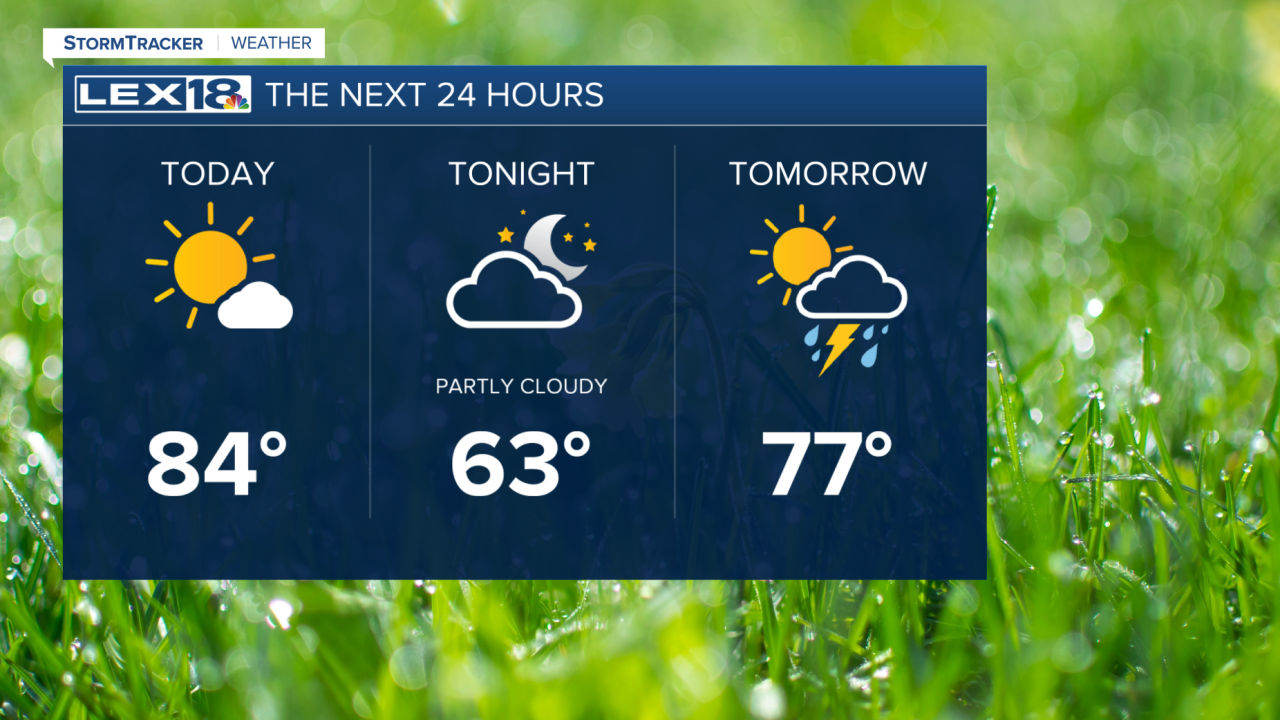


Happy Wednesday! Our string of summer heat continues through the rest of the workweek, with highs in the upper 70s on Thursday. Tonight will be another warm evening, with temperatures falling to the mid-60s by Thursday morning. Thursday will be more active as a cold front brings scattered showers and storms. A few of these storms could be on the stronger side with strong wind gusts and hail possible. Rain will move out by evening, leaving us with highs in the 80s on Friday. We stay warm for most of Saturday before another strong cold front passes through, bringing more showers and storms. Just like Thursday, we may see a few strong storms along the front. Cooler temperatures arrive by Sunday, with highs dropping to the 60s to start the workweek.
