



We have enjoyed another beautiful afternoon across Central and Eastern Kentucky, with plenty of sunshine and temperatures climbing into the mid to upper 60s!
However, some big changes are heading our way as we move through the evening hours. Showers and a few thunderstorms will begin moving into the region late Wednesday afternoon and continue through the evening before much colder air arrives Thursday.
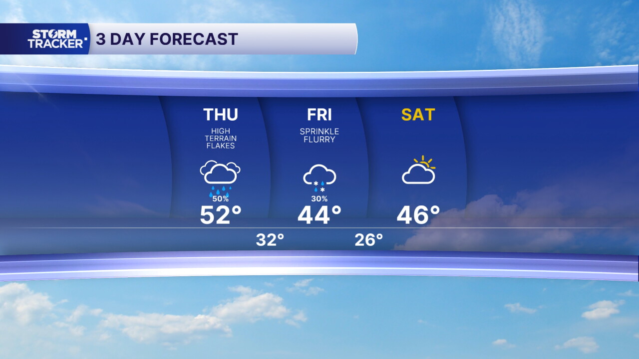
Behind this system, we'll see temperatures take a big drop, with afternoon highs struggling to reach 50 degrees heading into the weekend. We could even see a few snow flurries before the week is over!
Showers and Storms Arrive Wednesday Evening
After a sunny and mild start to Wednesday, clouds will begin increasing as our next weather system approaches.
A cold front will push across Central and Eastern Kentucky late Wednesday afternoon and evening, bringing scattered showers and a few thunderstorms.
The best chance for rain will be between 4 PM and midnight, with showers moving from west to east across the region.
While the overall severe-weather threat remains low, a few stronger storms could produce gusty winds and frequent lightning.
Thankfully, this system will move through fairly quickly, keeping rainfall totals relatively light. Most locations could receive around a quarter of an inch of rain, although some heavier showers could produce locally higher amounts.
Much Colder and Windier Thursday
Once the cold front pushes through Wednesday night, we'll notice a big change in our temperatures!
Much colder air will quickly move into Central and Eastern Kentucky on Thursday, with afternoon highs only reaching the upper 40s and low 50s.
That's a noticeable difference compared to the mild temperatures we've been enjoying over the past several days.
Along with the colder air, Thursday will be rather windy, with sustained northwest winds around 10 to 15 mph and gusts potentially reaching 30 mph.
The combination of colder temperatures and gusty winds will make it feel even chillier outside.
Could We See Our First Snow Flurries?
Believe it or not, we could even see a few snowflakes flying before the week is over!
As colder air moves into the region Thursday night into Friday morning, there is a small chance that lingering moisture could produce a few light snow flurries, especially across Eastern Kentucky.
However, confidence remains low because enough moisture would need to stick around after the cold front moves through.
If we do see any flurries, no snow accumulation is expected, especially with the ground still relatively warm.
Freezing Temperatures and a Chilly Weekend Ahead
The colder weather will stick around through Friday and into the weekend.
Afternoon highs Friday through Sunday will struggle to climb above 50 degrees in many locations, making for a much colder stretch of November weather.
Overnight temperatures will also take a big drop, with lows falling into the low to mid 30s Friday morning.
By Saturday morning, widespread temperatures in the 20s will be possible, with freezing conditions expected to continue during the overnight and early morning hours into next week.
The good news is that high pressure will move into the region by the weekend, bringing a stretch of dry weather that should last into early next week.
Temperatures may gradually moderate as we head into the new workweek, but chilly mornings will remain part of the forecast.
For now, enjoy the last bit of mild weather Wednesday afternoon before showers and storms arrive this evening and we trade our pleasant fall temperatures for a much colder end to the week!
 Facebook
 TikTok
 YouTube
 Instagram
 Threads
 X
