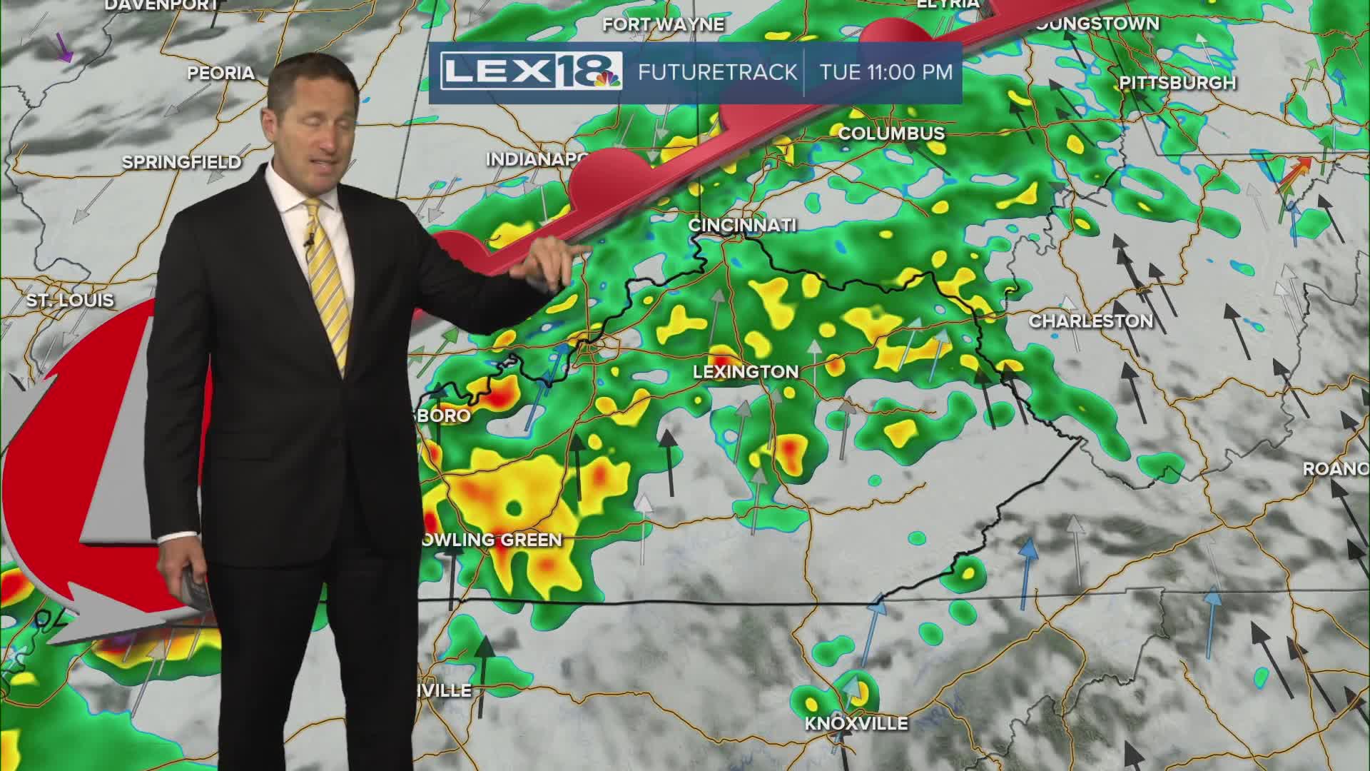


Scattered Monday morning showers and a few storms will give way to a mostly to partly cloudy afternoon. Highs will top out above normal after that very cool Derby weekend, in the upper 70s to around 80° southeast. More widespread showers and storms develop Tuesday into Wednesday as a slow moving front pushes through the Commonwealth. Watch for strong, gusty storms and locally heavy rain. We're in for beneficial rainfall to combat the drought with amounts in the 0.5" to 1" range. We'll also trend cooler with all the clouds and rain and eventually a cold front tracking east. Highs will fall to around 70° Tuesday and bottom out well below normal, around 60° Wednesday and Thursday.
Some Much Needed Rain for a Few Days
A Brief Warmup Monday, Back to Below Normal Midweek
