

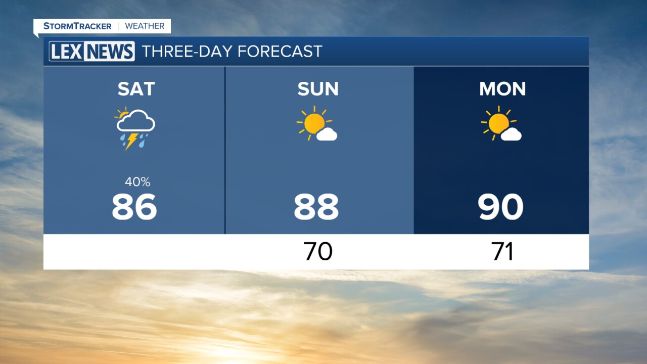


We are starting off this Saturday with plenty of clouds across the area, but we are seeing a few peeks of sunshine here and there. That mix of sun and clouds will continue through the rest of the morning and into the early afternoon before our attention turns to the chance for a few showers and thunderstorms later today.
Isolated Storms Possible This Afternoon
As temperatures warm through the afternoon, we will have enough instability around for isolated to scattered showers and thunderstorms to develop. Not everyone will see rain today, with coverage expected to remain fairly limited, but keep the rain gear nearby if you have outdoor plans.
The better opportunity for storms looks to be across southern Kentucky, particularly south of the Western Kentucky and Bluegrass parkways. Any storms that develop will likely be slow-moving and capable of producing torrential downpours, gusty winds and frequent lightning.
Outside of the rain chances, it will be another warm and humid afternoon. Temperatures will climb into the upper 80s, with a few locations potentially getting close to 90 degrees.
Storms Fade Away This Evening
Any showers and thunderstorms that develop this afternoon should gradually begin to fizzle out as we head through the evening and lose the daytime heating that helped fuel them.
That should leave us with a quieter night across central and eastern Kentucky. Skies will remain partly to mostly cloudy at times, with temperatures only dropping into the upper 60s and lower 70s by Sunday morning. With plenty of moisture still around, it will continue to feel warm and muggy overnight.
Hotter Weather Returns Sunday
Sunday looks considerably quieter for most of the area as we begin a stretch of drier and hotter weather.
We should see more sunshine throughout the day, helping temperatures quickly climb into the upper 80s and lower 90s by Sunday afternoon. Humidity will remain noticeable, with dew points in the lower to middle 70s making it feel even hotter. Heat index values could reach the middle and upper 90s during the hottest part of the afternoon.
There is still a very isolated chance for a shower or thunderstorm, especially across our northeastern communities, but the overwhelming majority of us should remain dry.
Heat Builds Into Early Next Week
The hotter weather will stick around as we begin the new workweek. Monday looks mostly dry with plenty of sunshine and afternoon temperatures once again reaching the lower 90s.
Tuesday should start on a similar note, with temperatures once again climbing into the lower 90s. Most of the day currently looks dry, but changes will begin arriving later Tuesday as our overall weather pattern becomes more active.
Storm Chances Increase Midweek
By the middle and latter portions of next week, our weather pattern could become much more unsettled.
Multiple days of shower and storm opportunities for clusters of showers and thunderstorms are possible from late Tuesday through the end of the workweek.
With additional clouds and rain chances around, temperatures should back down slightly by Wednesday through Friday, with afternoon highs generally returning to the upper 80s.
For now, enjoy the quieter and hotter stretch Sunday through the first part of next week!
