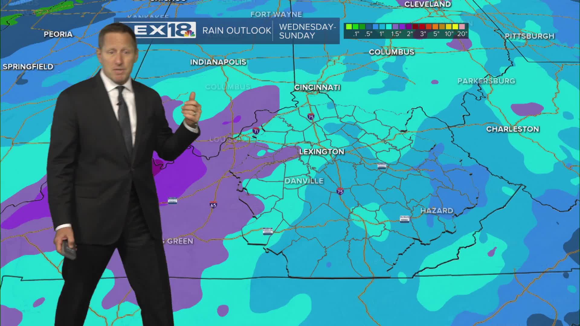


A front stalled along the Ohio River will bump up cloud cover slightly midweek but won't bring much rain. Expect partly to mostly sunny skies from north to south Wednesday with highs in the low to mid 70s. Overall, another very nice day. The front slides south Thursday and we'll end up mostly sunny and a little cooler with near normal highs on either side of 70°. Expect a warm surge into the weekend as the wind shifts ahead of active weather. Highs will climb to the mid 70s Friday and max out in the upper 70s Saturday. Widespread showers and storms are likely Saturday night into Sunday. A few Saturday evening showers may impact the UK/Texas game, but most will develop overnight. The better chance for severe weather will stay west/southwest but watch for a few strong storms and heavy rain late in the weekend.
Still Looking Good Wednesday
Tracking Active Weather Later this Weekend
