

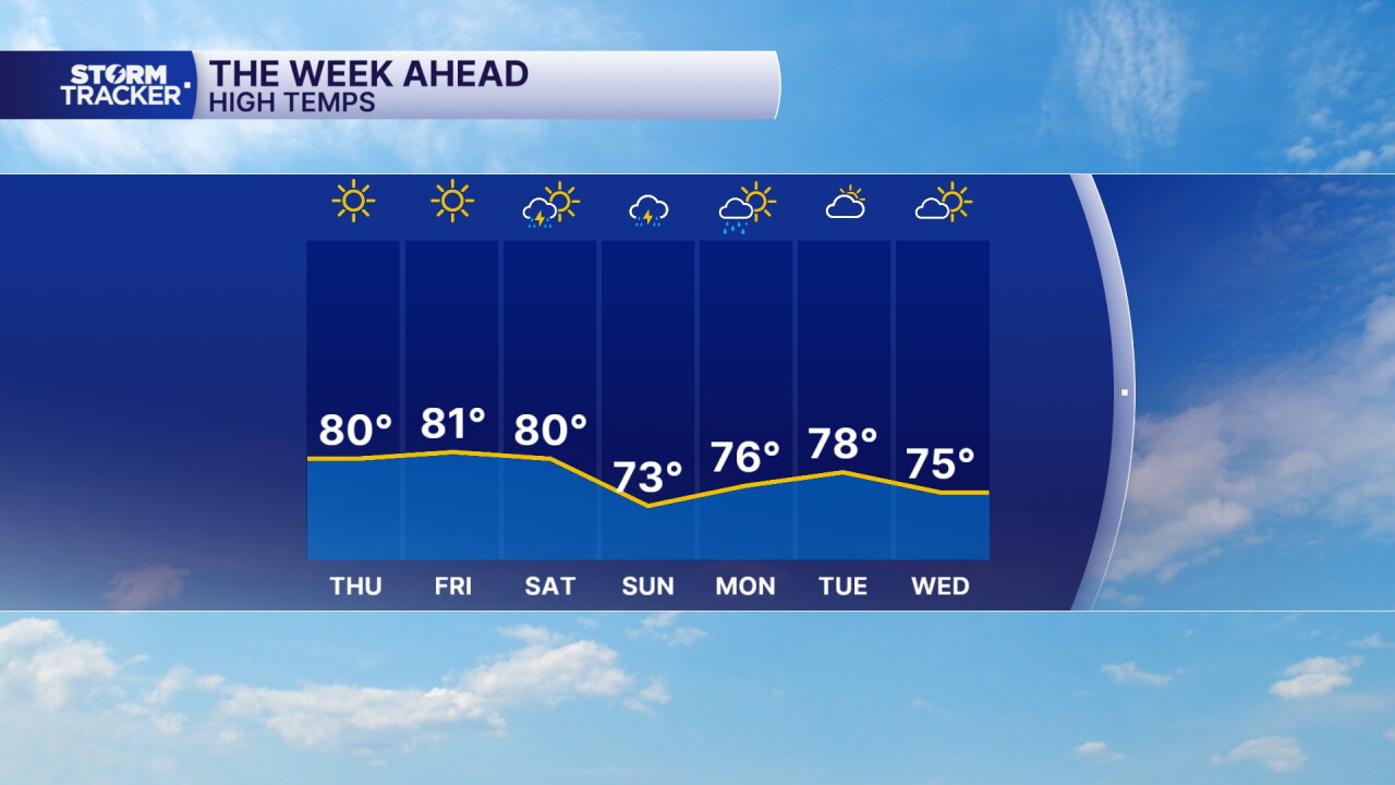
A cool front tracking south will kick the wind back to the north/northwest Thursday and pump the brakes on our warmup. Expect plenty of sunshine with highs holding in the upper 70s to around 80°. Friday will end up much the same. This weekend, all eyes are on the gulf coast with hurricane Isaias set to make landfall Friday night. It will slowly track north and the remnant low will bring tropical moisture with it. The timing is terrible with the first showers developing down south Saturday afternoon; rain could impact the UK game at Kroger Field Saturday night. It will also be beneficial since we've slowly been sliding back into a drought. Watch for widespread showers and a few thunderstorms Saturday night through Sunday with high falling back into the 70s.
Still Sunny and Unseasonably Warm Thursday
Rising Chance for Rain Later this Weekend
weather


Posted
 Facebook
  TikTok
  YouTube
 Instagram
 Threads
 X
XCopyright 2026 Scripps Media, Inc. All rights reserved. This material may not be published, broadcast, rewritten, or redistributed.
