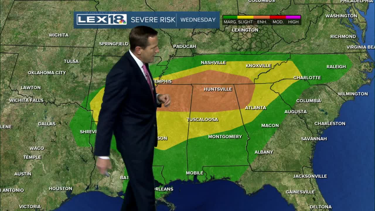
After a few morning showers wind down we're left with a stalled front, mostly cloudy skies and unseasonably warm highs in the 60s again midweek. Another slug of gusty showers and t-showers will run the front Wednesday evening into early Thursday morning. Watch for a few strong storms and heavy rain, mainly over southeastern counties. Thursday will bring a brief break in the action with just a few lingering showers. Another wave of showers and storms will fire up to usher in 2022 Friday and Saturday. After that, a cold front finally tracks east, clearing out the rain and tanking the temperature late in the weekend. We may even see some brief, mixed precipitation as the rain wraps up Saturday night. The first few days of early January are trending MUCH colder!
Thursday will bring a brief break in the action with just a few lingering showers. Another wave of showers and storms will fire up to usher in 2022 Friday and Saturday. After that, a cold front finally tracks east, clearing out the rain and tanking the temperature late in the weekend. We may even see some brief, mixed precipitation as the rain wraps up Saturday night. The first few days of early January are trending MUCH colder!


Posted
and last updated
