

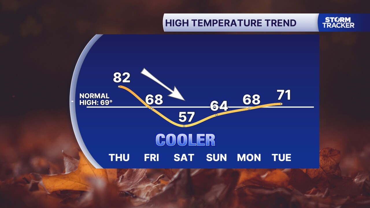
A warm front lifts north Thursday, and we'll see lingering clouds with a few showers and storms. Highs will stay in the low to mid 80s, very warm but not quite the record levels we've experienced the last two days. A cold front tracks east Friday morning sparking more scattered showers and tanking the temperature this weekend. The coldest air of the season invades behind it with Friday's high falling to the upper 60s and Saturday bottoming out in the upper 50s. The first patchy frost of the season is possible Sunday morning with clear skies and lows in the mid to upper 30s.
weather


Posted
 Facebook
  TikTok
  YouTube
 Instagram
 Threads
 X
XCopyright 2026 Scripps Media, Inc. All rights reserved. This material may not be published, broadcast, rewritten, or redistributed.
