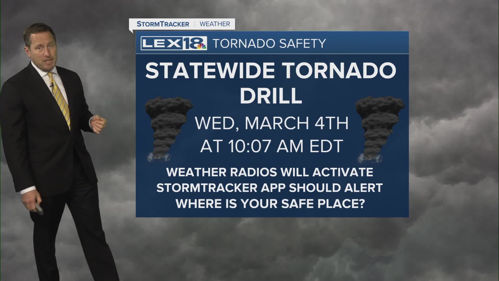


Unsettled and unseasonably warm weather persists midweek with Wednesday's high around 70° and scattered showers and t-storms. Watch for locally heavy rain, especially over northern counties where a flood watch is in effect. As part of severe weather awareness week, the statewide tornado drill is scheduled at 10:07 AM. We could see a few strong storms out west Wednesday evening into early Thursday morning as additional showers and storms fire. We'll quiet down to start the weekend and see highs soaring to near record levels, in the mid to upper 70s before another round of strong storms and heavy rain rolls in Saturday night. Highs will drop back to the 60s Sunday after we "spring forward" into Daylight Saving Time.
