


Many of us enjoyed a good soaking rain Monday and Monday night. For a lot of us, the rainfall was needed and generous in the inch to inch and a half range. However, not everyone saw it. There were are parts of southeastern Kentucky that barely got the sidewalk wet.

There will be more thunderstorms coming, with the bulk of those arriving tomorrow afternoon. Locally heavy rain will remain a possibility and there is at least a marginal risk of a thunderstorm or two that could produce a briefly flooding downpour.

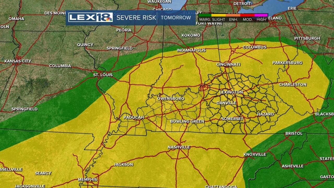
Not only will there be a risk of heavy rain storms, there will also be the possibility of strong and severe thunderstorms with large hail or damaging wind gusts. The Storm Prediction Center has all of Kentucky in the 'slight' risk of severe storms tomorrow afternoon and evening.

It simply means you'll need to Stay Weather Aware on Wednesday. It's not going to be a widespread outbreak, but the chances will persist.
After those storms, a cold front will come through and introduce nature's air conditioning into the weekend.
