



It has been an active Saturday across Central and Eastern Kentucky. We started the day with showers and thunderstorms before sunshine returned and allowed temperatures to quickly heat up during the afternoon.
A few showers and storms have continued across portions of Northern Kentucky and near the I-65 corridor this evening, while much of our area has remained dry. We are also keeping an eye on additional storms farther west as a cold front works its way through the region tonight.
Watching a few more storms this evening
Scattered showers and thunderstorms will remain possible over the next few hours, with the better chances generally across western portions of the area.
Any stronger storm that develops could produce gusty winds and possibly some small hail. While widespread flooding is not expected, a storm repeatedly moving over the same location could produce locally heavy rainfall.
Cold front brings big changes tonight
The cold front responsible for our storm chances will continue pushing through the region tonight, eventually bringing an end to the showers and storms.
Skies should begin clearing late tonight into early Sunday morning. Temperatures will fall into the upper 60s and low 70s, but the biggest difference you'll notice by Sunday morning will be the humidity.
Much drier air will filter into the region behind the front, making it feel significantly more comfortable outside.
Sunshine and lower humidity Sunday
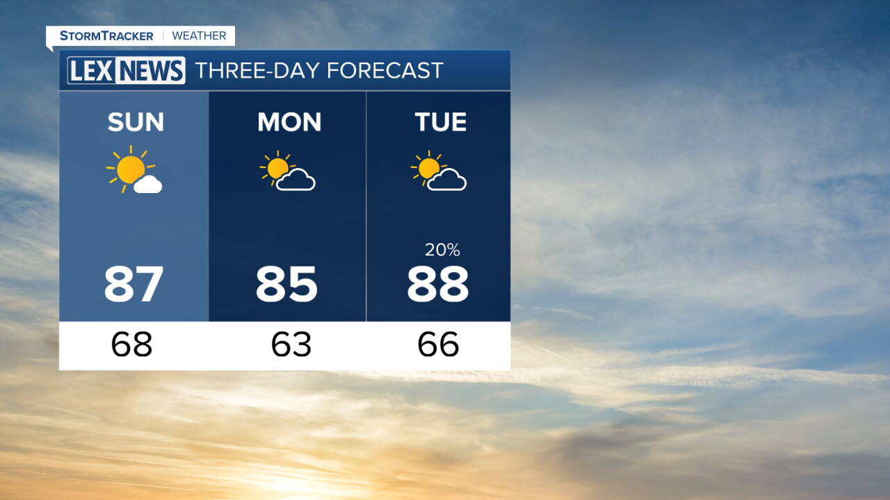
Sunday is shaping up to be a beautiful day across Central and Eastern Kentucky.
Expect plenty of sunshine throughout the day with much lower humidity. Afternoon temperatures will generally reach the low to mid 80s, with a few locations potentially climbing into the upper 80s.
Sunday night will be even cooler, with overnight temperatures falling into the low to mid 60s.
Great weather for Labor Day
If you have outdoor plans for Labor Day, the forecast is looking great.
High pressure will keep us dry Monday with plenty of sunshine and very little chance for rain. Temperatures will generally reach the mid to upper 80s during the afternoon, and humidity should remain fairly comfortable.
Temperatures climb again midweek
Our break from the heat won't last very long.
Winds will eventually shift back out of the south, allowing warmer air to quickly return. High temperatures are expected to climb back into the 90s Tuesday and Wednesday.
Another weather system could move into the region Wednesday night into Thursday, bringing our next opportunity for showers and thunderstorms along with slightly cooler temperatures. Highs could return to the mid and upper 80s behind that system later in the week.
