

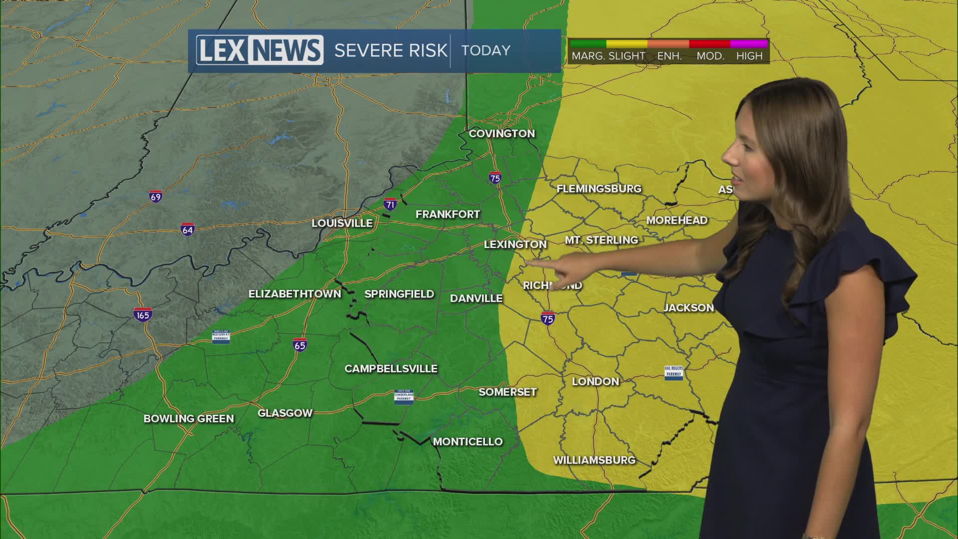


We are starting Saturday with some patchy dense fog across the area, especially in parts of Southeastern Kentucky. Visibility should gradually improve over the next few hours as the fog burns off, giving way to some sunshine before our next weather system arrives.
Storms return this afternoon
We should see at least some sunshine to start the day, but clouds will increase throughout the morning as a cold front approaches the area. Showers and thunderstorms are expected to begin developing by late morning into the early afternoon before becoming more widespread across parts of the region.
The main window for storms looks to be from around 1 p.m. through 8 p.m. EDT, with the greatest potential for stronger storms across Northern and Eastern Kentucky.
The Storm Prediction Center has parts of Eastern Kentucky highlighted in a Level 2 of 5 Slight Risk for severe weather, while Lexington and areas farther west are under a Level 1 of 5 Marginal Risk.
Damaging wind gusts will be the primary concern with any stronger storms, along with the potential for hail. Make sure you have a way to receive weather alerts if you have outdoor plans this afternoon or evening.
Clearing out Saturday night
Showers and storms should gradually push southeast and out of the area by late evening as the cold front moves through.
Skies will begin to clear overnight, with temperatures dropping into the low to mid 60s. Some patchy fog could redevelop in areas that receive rainfall Saturday afternoon.
More importantly, drier and less humid air will begin filtering into the region behind the front.
WATCH: Hour-by-hour look at storm chances in Kentucky on Saturday
Beautiful weather returns Sunday
Sunday is looking like a great day across Central and Eastern Kentucky.
High pressure will take control, bringing plenty of sunshine, lower humidity and afternoon temperatures generally in the low 80s. Dew points dropping into the 50s and low 60s will make it feel noticeably more comfortable outside.
The pleasant weather sticks around into Monday and Tuesday, with cool mornings and comfortable afternoons. Some locations could even fall into the upper 50s during the early morning hours.
Temperatures warm again next week
Temperatures will gradually begin warming closer to normal by the middle of next week, eventually climbing back toward the mid to upper 80s.
There is some uncertainty surrounding rain chances during the middle of the week, but another system and weak cold front could bring a better opportunity for showers and thunderstorms by Thursday. Drier air should return behind that front.
