



We are starting Saturday on an active note across parts of Northern and Central Kentucky, where showers and thunderstorms have been moving through the area this morning. These storms have produced plenty of lightning, heavy downpours and, at times, gusty winds.
The morning activity should gradually move out later this morning, giving us an opportunity to see some sunshine return. That sunshine could quickly heat things back up and help set the stage for another round of thunderstorms later this afternoon and evening.
Morning storms gradually move out
Showers and thunderstorms will continue impacting portions of Northern and Central Kentucky early this morning before gradually weakening and moving out later this morning.
Some of the stronger storms have been capable of producing gusty winds in addition to frequent lightning and heavy rainfall. Once this first round moves out, we should get a break from the rain and potentially see sunshine return for a portion of the day.
Exactly how quickly the morning clouds and storms clear will play an important role in how hot we get and how much instability can build for additional storms this afternoon.
Heat and humidity stick around
Despite the morning storms, another hot and humid afternoon is expected, especially where we see several hours of sunshine.
Temperatures could climb back into the low to mid 90s, with some locations farther west potentially reaching the mid to upper 90s. When you factor in the humidity, heat index values could climb to around 100 degrees or higher.
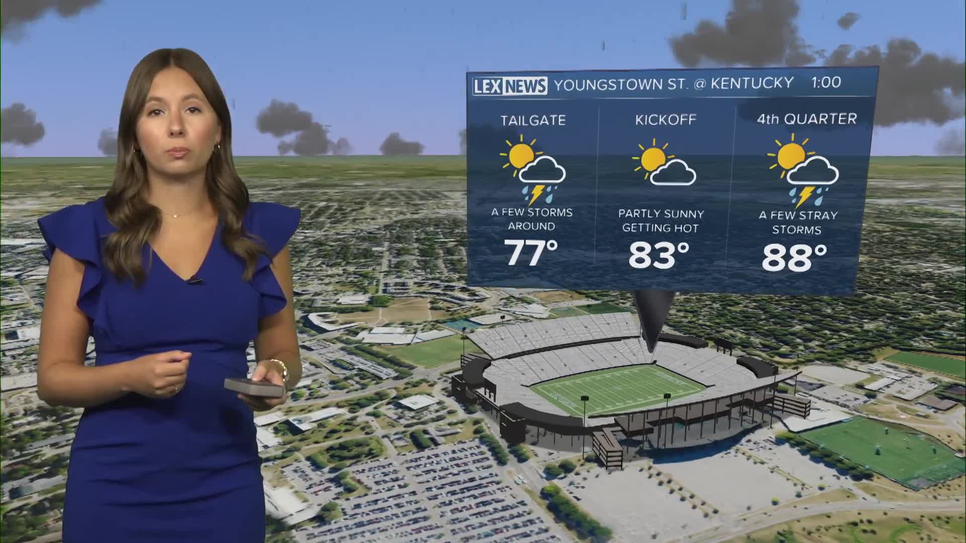
A Heat Advisory remains in effect for areas generally along I-75 and west through this evening. So if you are heading out to the UK football game today against Youngstown State or just any outdoor plans in general, make sure to stay hydrated and take frequent breaks.
Stronger storms possible this afternoon
Another round of scattered showers and thunderstorms could develop during the afternoon as a weak cold front pushes through the region and interacts with boundaries left behind by this morning's storms.
The entire viewing area is highlighted in a Level 2 out of 5 Slight Risk for severe thunderstorms this afternoon and evening.
The main concern with any stronger storms will be damaging wind gusts. The greatest opportunity for stronger storms looks to be from roughly 3 p.m. through 10 p.m., particularly across areas farther east.
Not everyone will necessarily see a thunderstorm, but anyone with outdoor plans should keep an eye on the radar and have a way to receive weather alerts throughout the afternoon and evening.
Cooler weather arrives Sunday
Storms should gradually wind down later tonight as the cold front works through the area, setting us up for a much quieter Sunday.
Plenty of sunshine returns for the second half of the weekend, and temperatures will finally take a step back. Afternoon highs should generally reach the upper 80s, making it feel slightly cooler compared to the prolonged stretch of 90-degree heat we've experienced recently.
More seasonable temperatures should stick around into Monday before temperatures begin warming again toward the middle of next week.
