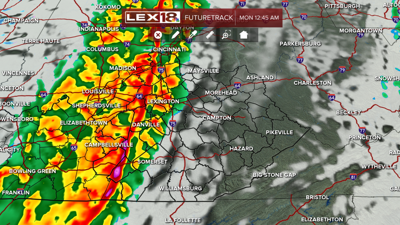


Happy Sunday! Sunday will be a warm, very windy day, with afternoon highs in the lower 70s. Wind gusts will reach 30-40 mph and could blow unsecured objects across the neighborhood. However, our quiet afternoon will turn into an active evening by the time we head off to sleep. A strong cold front will pass through the Commonwealth overnight. Strong to severe storms will be possible with strong straight-line winds and a tornado or two being the highest threats for the Bluegrass. Since this is an overnight event, make sure to have multiple ways to receive alerts, such as leaving your ringer on or using a NOAA weather radio, before heading to sleep. Our severe threat will start at 10 PM and end before the morning commute, leaving us with a return to winter-like temperatures. Highs will struggle to reach the upper 30s with overnight lows in the teens on St. Patrick's Day. By midweek, we will return to the 60s and enter a calmer weather pattern.
Strong to severe storms possible Sunday night
Have multiple ways to receive alerts while you sleep Sunday night
