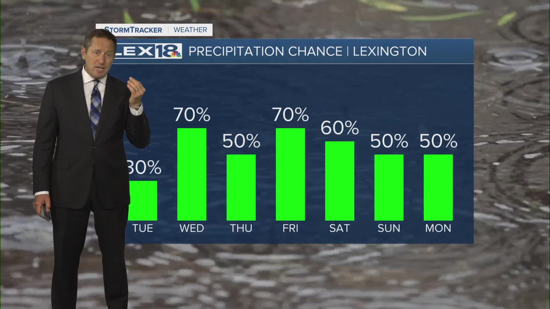


After hitting our first high in the 90s of the year, we're staying unseasonably warm Tuesday but adding in the chance for a few showers and storms. Expect highs in the mid to upper 80s with partly to mostly cloudy skies. A few showers and storms will develop during the day but watch for a round of strong to severe storms Tuesday night. We're under a slight to marginal risk for severe storms. The line will gradually weaken overnight, so the most likely area to see storms that could produce damaging wind will be north/northwest closer to the Ohio River. Highs will fall to near normal (upper 70s) Wednesday with scattered showers and storms lingering.
Strong to Severe Storms Possible Tuesday Evening
Near Record Heat Slowly Backing Off
