

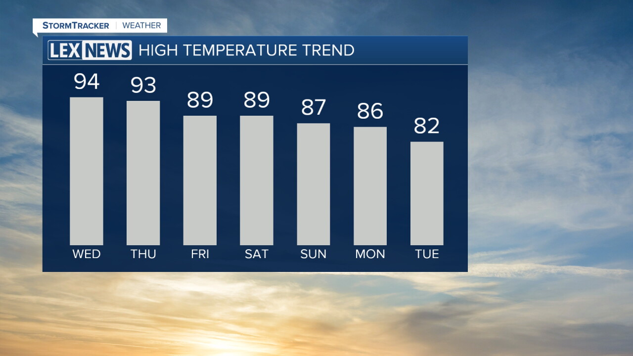


We are feeling a lot warmer across Central and Eastern Kentucky Tuesday compared to this time yesterday. After Monday's brief taste of cooler weather, temperatures have quickly jumped back into the low 90s this afternoon with lots of sunshine across the area.
Humidity has also increased, making it feel even hotter outside. This is just the beginning of another stretch of unseasonably hot September weather, with temperatures climbing even higher over the next few days.
Heat Builds Through Thursday
A warm front will lift through the region, allowing even hotter and more humid air to settle in Wednesday and Thursday.
Afternoon highs will reach the low 90s across the Bluegrass and areas along and east of I-75, while locations farther west could climb into the mid and upper 90s.
Once you factor in the humidity, heat index values will reach the upper 90s to around 100 degrees across much of the area. Farther west, it could feel as hot as 100 to 105 degrees during the afternoon.
This late-season heat is especially important to take seriously because temperatures will remain unusually warm for several days. Overnight lows will only fall into the low to mid 70s Wednesday and Thursday mornings, providing limited relief from the heat.
Make sure to stay hydrated, take frequent breaks if you're spending extended periods outside and try to avoid strenuous outdoor activities during the hottest part of the afternoon.
Most of Us Stay Dry
Despite the heat and humidity, most of the area should remain dry through the end of the workweek.
There is a very small chance for an isolated shower or storm at times, but widespread rainfall is not expected. A front will remain nearby through Wednesday before lifting back north, but the strong ridge of high pressure overhead should prevent much activity from developing.
For most communities, sunshine and the heat will remain the main weather story.
A Few More Rain Chances Late in the Week
Rain chances will increase slightly Friday as a front begins working its way back toward the region.
Even then, chances remain relatively low at around 10% to 30%, with any showers or thunderstorms expected to remain isolated to scattered. Temperatures will also stay very warm, with highs generally in the upper 80s to low and mid 90s.
Saturday could bring another surge of heat as the front lifts back north, potentially allowing highs to climb back into the 90s once again.
Cooler Weather Arrives by Early Next Week
A more noticeable change looks increasingly possible toward the end of the weekend.
A stronger cold front is expected to move through late Sunday into early next week, bringing a better chance for showers and thunderstorms along with it.
Behind that front, temperatures should finally back down into the 80s by the beginning of next week, bringing some much-needed relief from this stretch of late-season heat.
