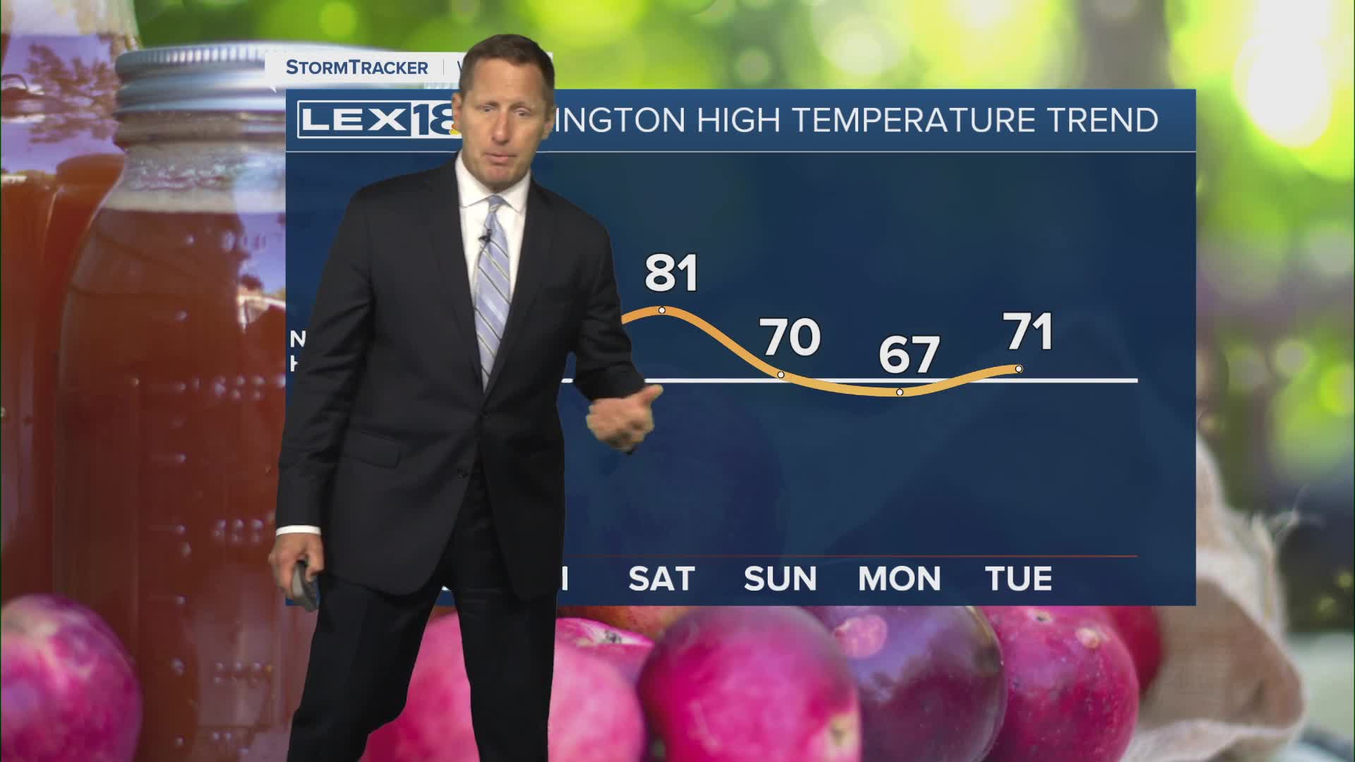


High pressure over the Great Lakes will keep a northeast wind flowing Thursday, keeping highs near normal, in the upper 60s to around 70 south. Friday will stay mostly sunny and end up a little warmer, in the low to mid 70s. A strong south/southwest wind sets up ahead of a late weekend cold front, sending highs soaring to the upper 70s, low 80s Saturday. Most of the rain will hold off until Saturday night into Sunday but watch for gusty wind and isolated showers toward the end of the UK-Texas game Saturday evening out at Kroger Field. Widespread showers and storms will develop overnight and continue Sunday as the cold front slides east. The main severe storm threat remains well to our west/southwest but watch for strong storms and heavy rain late in the weekend. Much cooler air follows for a few days next week.
Sunny and Slightly Cooler Thursday
A Weekend Warm Up with Active Weather in the Works
