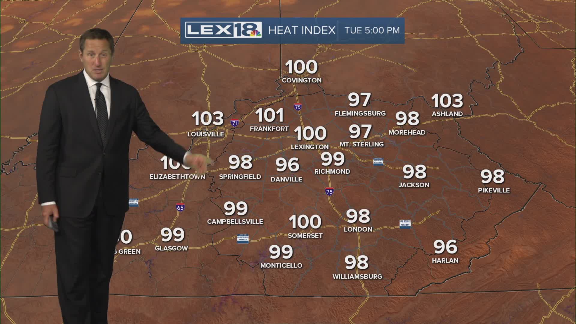


We continue our slow simmer as we slog through our first summer heat wave, expect high in the mid 90s with the heat index pushing and exceeding triple digits Tuesday and Wednesday. A heat advisory remains in effect. Stay hydrated and try to avoid the peak heat of the day, especially if you work outside. Like Monday, isolated afternoon showers and t-showers are possible but most will end up mostly to partly sunny and steamy. Moisture streaming in from the south will slowly ramp the chance for scattered showers and storms this weekend, mainly driven by daytime heating. A cold front early next week is our best chance to take the edge off of the heat and drop highs back into the 80s.
