

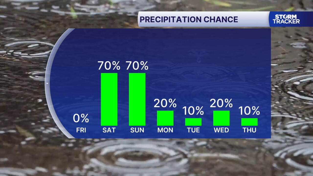
Our stellar run of fall days winds down Friday with increasing clouds and well above normal highs in the upper 70s to low 80s. We'll see cloud cover on the rise late in the day and overnight. The rest of the weekend is trending wet and unsettled as what's left of Hurricane Isaias tracks through. Expect gusty, cloudy and cooler conditions with highs back in the 70s as rounds of showers and occasional thunderstorms fire Saturday through Sunday. Overall rainfall totals will top out from 0.5" to 1.5", but we could see isolated 2" to 3" totals with repeated bursts of heavier rain over the same area. This will be beneficial rainfall for a drought parched Commonwealth but will also impact outdoor plans. Take a poncho to Kroger Field if you're going to the game Saturday evening.
The Remnants of Hurricane Isaias Soak the Commonwealth this Weekend
Rounds of Gusty Showers and Storms Saturday, Sunday
weather


Posted
 Facebook
  TikTok
  YouTube
 Instagram
 Threads
 X
XCopyright 2026 Scripps Media, Inc. All rights reserved. This material may not be published, broadcast, rewritten, or redistributed.
