


The Muggies we've been enduring today is also high octane storm fuel and it's just waiting for a spark. That will be a 'cold' front arriving this evening. We'll see a line of storms form with damaging wind being the primary threat along with lightning. A few folks may also have some brief and heavy downpours. Just stay Weather Aware as the storms do develop this evening.

The greatest severe threat appears to be between 9 and midnight, although the storms may be ongoing into southeast Kentucky in the hours after midnight. An 11:00 view of our FutureTrack shows the squall line cutting through central Kentucky heading southeast. The storms won't last too long at any one spot, but still could be nasty.

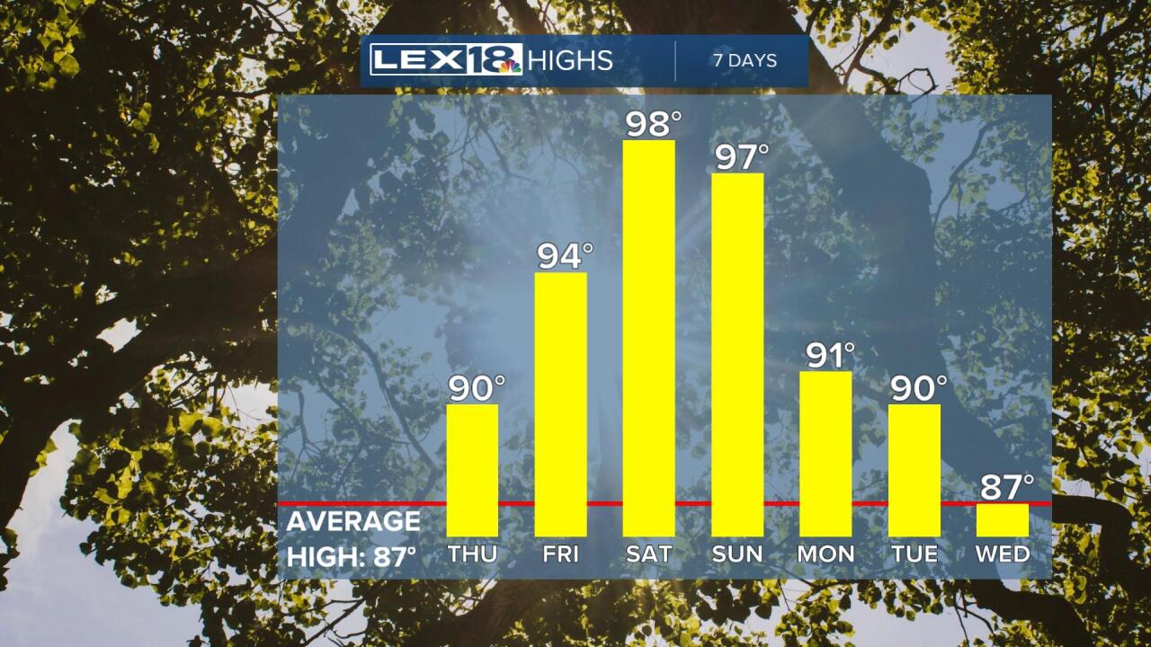
The next big thing will be the heat wave that's coming for the weekend. Even tomorrow, after the 'cold' front, we'll still be around 90, but the humidity will be much less. The heat begins to crank on Friday as we head into the mid 90s with the upper 90s looming for the weekend. It's likely you'll see a bank clock thermometer saying it's a 100 at some point, and it's even possible that one or two of our reporting stations could touch the triple digits. Regardless, the Heat Index will be over 100, so take it easy with the activities outside this weekend.

