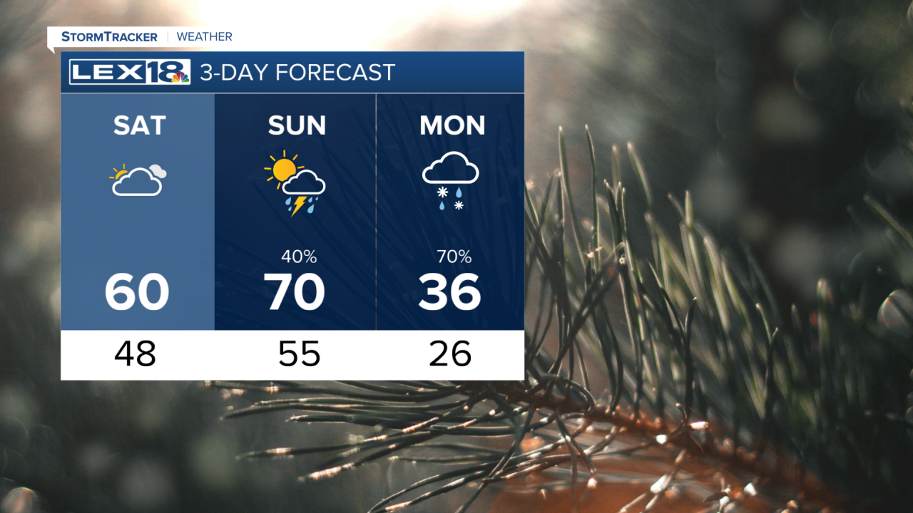


Happy Saturday! It will be a warm evening, with temperatures dropping to the mid-50s. Tonight will be our last warm night before a brutal cold front arrives tomorrow. Sunday will start warm and gusty as a strong cold front approaches from the west. We will break our record high on Sunday, with temperatures in the lower 70s. In the evening, the cold front will arrive, bringing showers and storms to the Commonwealth. We could see a few stronger storms along the front. On the back end, temperatures will be in the upper 20s to lower 30s, with a couple of snow showers. The cold weather will stick around, with temperatures falling back to winter highs through the start of the New Year.
Weekend warming trend continues
Highs to reach the 70s Sunday afternoon
