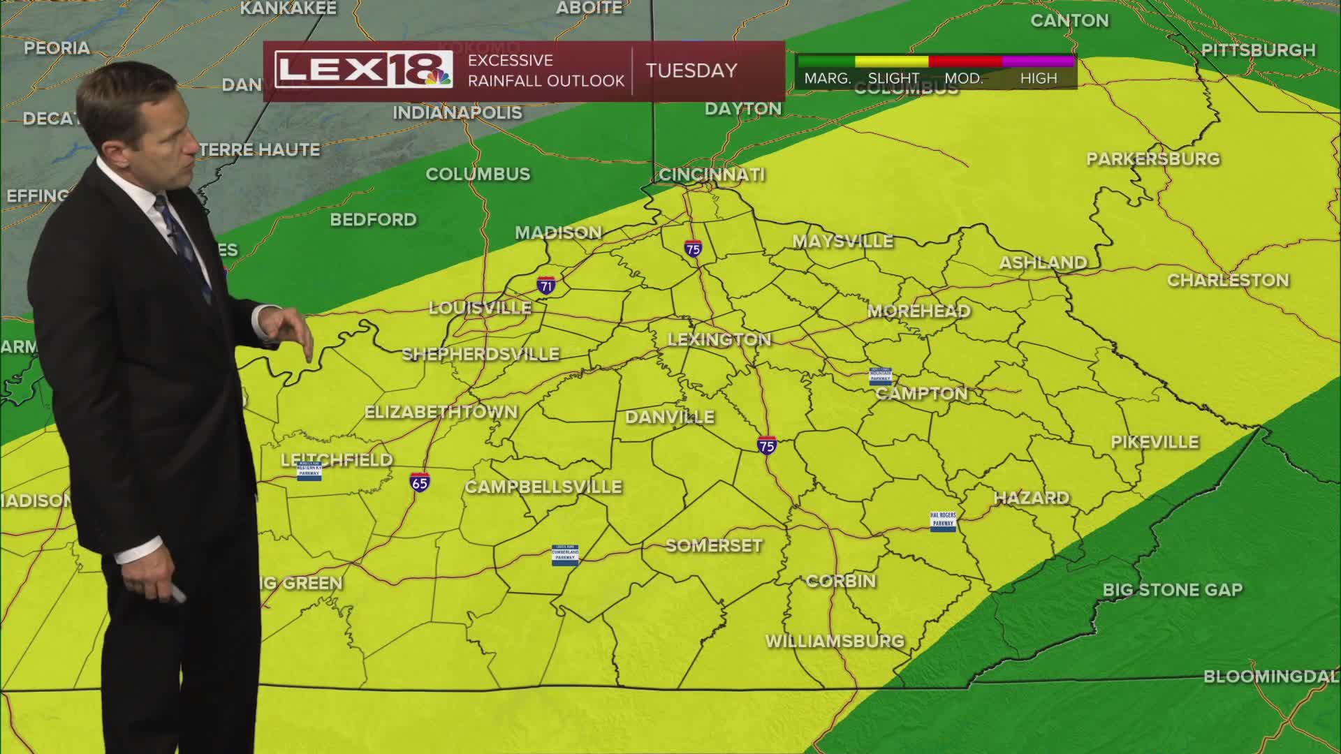


Expect widespread showers and storms Tuesday with heavy rain possible. This will be beneficial for our ongoing drought, but repeated rounds could lead to localized flooding. We're still in line for 1" to 3" of rain with isolated pockets of higher totals. Extensive cloud cover, rain and a cold front pushing east will keep highs in the low to mid 70s. Active weather winds down overnight and much cooler air follows. Clouds slowly clear Wednesday with highs around 70°. We'll bottom out in the upper 60s Thursday with overnight lows in the 40s. It'll finally feel like fall! This weekend is trending dry and warmer with highs back in the 70s.
