

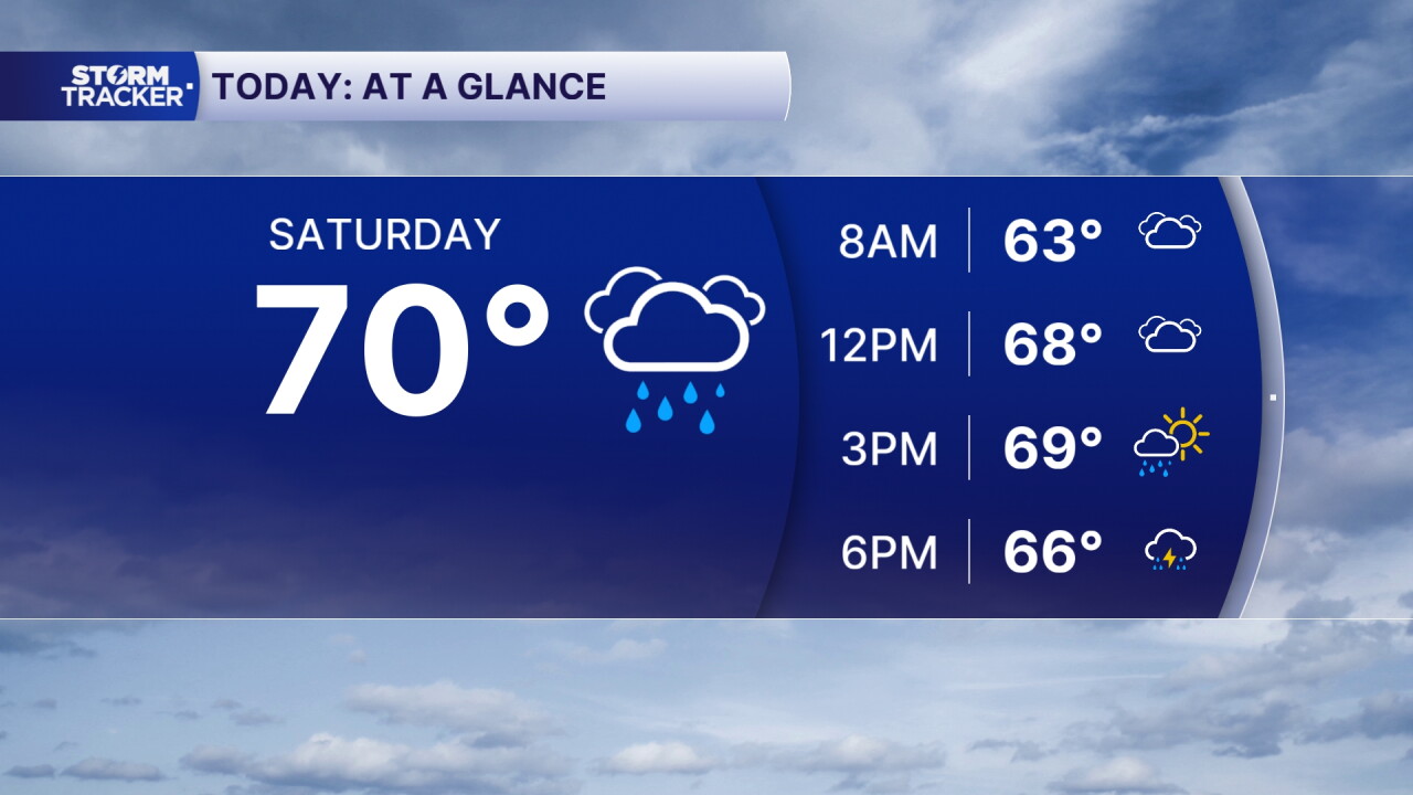


We are starting off dry across Central and Eastern Kentucky this Saturday morning, but that won't last much longer. Clouds are already streaming into the region ahead of the remnants of Hurricane Isaias, which will bring widespread rain and gusty winds to the area throughout the day.
Showers will begin pushing into Southern Kentucky later this morning before spreading north across the rest of the region. Rain will continue on and off through the afternoon and evening, with gusty winds becoming another concern as the system moves closer.
Rain and gusty winds arrive Saturday
As the remnants of Isaias move into Kentucky, expect periods of light to moderate rain throughout the day.
While a rumble of thunder can't be completely ruled out, widespread thunderstorms are not expected. Instead, the bigger concern will be the wind, with easterly gusts potentially reaching 30–40 mph, especially during the early afternoon.
Winds should gradually weaken later this evening as the center of the system moves closer to Eastern Kentucky.
Temperatures will also struggle to warm up today thanks to the clouds and rain, with afternoon highs generally staying in the upper 60s.
Rain could impact tonight's UK football game
If you're heading to Kroger Field for tonight's Kentucky vs. LSU football game, you'll definitely want to have your rain gear handy!
Periods of rain are expected to continue through the evening, potentially creating wet conditions for fans heading to the stadium and throughout the game.
While the strongest wind gusts are expected earlier in the afternoon, it could still be breezy during the evening as the remnants of Isaias move across the region.
Heavier rain possible overnight into Sunday
Rain will continue Saturday night into Sunday morning, with some of the heaviest rainfall potentially developing across Central and Eastern Kentucky.
Most locations are expected to receive around 0.5 to 1 inch of rain through Sunday morning. However, a few isolated areas across Central Kentucky and east of I-75 could pick up between 2 and 3 inches, especially where heavier bands of rain develop.
Some of those heavier showers could produce rainfall rates approaching an inch per hour, which could lead to localized flooding concerns in areas that receive repeated rounds of rain.
Showers gradually exit Sunday
We'll continue to see scattered showers Sunday morning, but conditions should gradually improve as the remnants of Isaias move east of the region.
Rain and clouds will begin clearing from west to east Sunday afternoon and evening, allowing some sunshine to return, especially across Western and Central Kentucky.
Afternoon highs will reach the upper 60s and low 70s.
Warmer and drier weather returns next week
The good news is that we'll dry things out by Monday as warmer air begins moving back into the region.
Temperatures will rebound into the upper 70s and low to mid 80s Monday, with some locations potentially climbing into the upper 80s Tuesday, especially closer to the Tennessee border.
Dry weather should continue through the first half of the week before a few additional rain chances potentially return Thursday and Friday.
 Facebook
  TikTok
  YouTube
 Instagram
 Threads
 X
X