

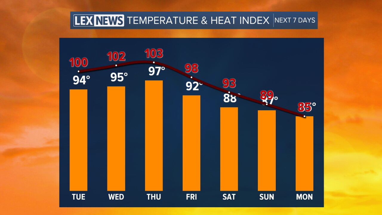


Welcome to September and meteorological fall here in Central and Eastern Kentucky, but unfortunately someone forgot to tell Mother Nature! Some of the hottest air we've seen in several weeks and practically all summer long is settling into the region and will be hanging around the next few days. Under mostly sunny skies, afternoon highs will surge into the mid-90s, a good solid 10 degrees above average for the beginning of the new month. Even though humidity levels won't be off the charts, with such hot air expected it won't take much to get heat indices at or over the 100° mark so keep that in mind and slow it down during the hottest part of the day.
Unfortunately the heat isn't going anywhere anytime soon as the core of the upper level heat bubble settles right over the region into the mid to late week. Afternoon highs will remain into the mid-90s with lots of sunshine as the heat index values sneak into the low 100s. For now all the Heat Advisories are just north and west into the late week but depending on how things play out on Tuesday, we could see those expected into the Bluegrass. Even without those in place, just use some common sense and remember all the heat safety tips if you have to be outdoors for any length of time. It's conceivable that highs could sneak into the upper 90s Thursday, which could be one of our hottest days of 2026.
We will see some changes on the way to close out the week and head into the Labor Day weekend as a back door cold front slides through the Ohio Valley as a trough digs through the northeast. With the front in place and plenty of available moisture around, scattered showers and thunderstorms will be possible, especially on Friday and Saturday. The positive is that it will take the edge of the big heat with afternoon highs dropping back into the upper 80s by Saturday, but the storm threat will be in play as Kentucky kicks off the 2026 football season against Youngstown State at Kroger Field at 1pm. Plan on a warm day with some storms possible if you are heading out to the game, or for any outdoor holiday plans.
The big question will be how far to the southwest we'll see the front push, which will be the key to any lingering storm chances and the break from the big heat, Right now it appears temperatures will be closer to average with highs in the mid-80s Sunday and into Labor Day with most locations looking dry for th holiday on Monday.
